The Long Game: What the World Cup Says About American Cities
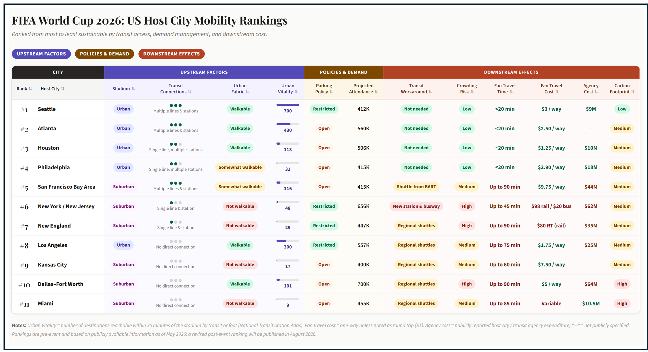
If you only have time to read one thing, take a look at this summary matrix. Check back in August for new rankings that incorporate each city’s performance in managing World Cup transportation.
This essay incorporates research conducted by Claude AI. Source material and references are available upon request. Some of the content on stadium history has also been generated by Claude. The essay’s overall framework, methodological approach, point of view, and conclusions are my own.
Picture a soccer stadium at kickoff. Seventy thousand people on their feet, a single roar. This summer, millions of spectators will travel from around the world to cities in North America for the FIFA World Cup. Millions more have been involved in planning the events or will be impacted by them: the star soccer player, the devoted fan, the billionaire stadium owner, the shuttle driver, the commuter, the American taxpayer watching the game on TV. What connects all of us is a set of forces already in motion long before the first whistle.
This is an essay about convergence. Not the convergence of nations on a soccer field, though that is happening too, but the culmination, in eleven American host cities, of four forces that have been building for decades: the politics of sports infrastructure (who built what, where, and at whose expense); the politics of public transit investment (which cities expanded their transit networks, and which abandoned them, which communities were served and which were bypassed); the politics of FIFA's selection process (which cities were chosen, based on what criteria, at what cost, and under what terms), and the specific choices made by host city organizers about parking, demand management, and transit incentives in the months before the tournament began. These forces have been shaping American cities for generations. The World Cup concentrates them, brings them to a single point in time and space, makes their consequences visible, and invites us to ask what we value about our cities, and whether our values match what the global audience will experience.
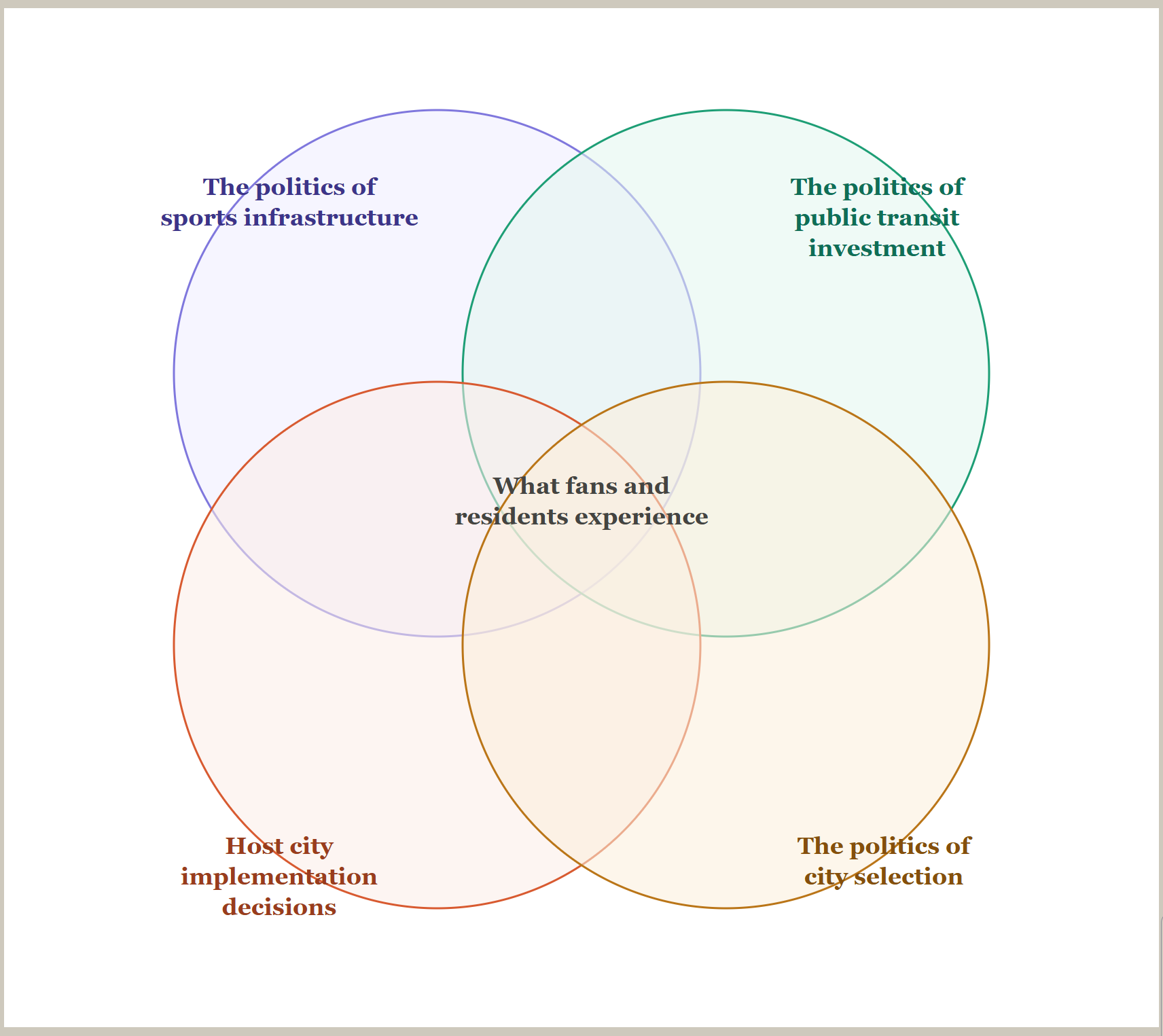
Who doesn’t love a Venn Diagram?
These four forces have converged differently in each of eleven American host cities to produce the conditions that fans, residents, commuters, planners, and mayors will navigate this summer, and the diagram below shows how.
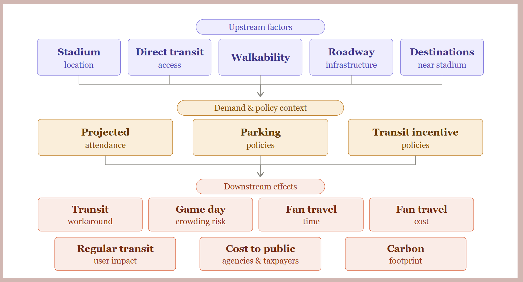
Each city is impacted by stadium siting, transit investment, land use and transportation decisions often made decades in the past. These upstream factors inform the options that city planners have and how fans and regular transit riders will experience the World Cup. The number of games and projected attendance also matters, and so do the specific choices that local leaders are making in different cities on how the region will function this summer. Upstream factors and policy choices directly contribute to how costs and benefits will be distributed to fans, non-fans, to public agencies, and, in the case of an event’s carbon footprint, to the global community.
A Brief History of the 2026 World Cup Selection
One of the four rings in the Venn diagram above applies uniformly across all eleven cities: the politics of FIFA's selection process. Unlike sports infrastructure or transit investment, which vary significantly by city, region, and decade, the FIFA process was a single negotiation conducted largely on FIFA's terms, producing a single set of financial and operational conditions that every host city inherited. It is the most useful place to start.
The Fédération Internationale de Football Association was founded in Paris in 1904 by seven European football associations seeking to standardize rules and organize international competition. Today it claims 211 member federations and governs every dimension of the global game.
For most of its history, FIFA operated as an opaque patronage network with its 211 equal-vote members serving as a market for vote-buying by presidential candidates and host nation bidders alike. The corruption ran deep and long: FIFA president João Havelange and his son-in-law took millions in bribes from a sports marketing firm; his successor Sepp Blatter presided over a two-decade conspiracy in which more than $150 million in kickbacks were paid to officials in exchange for television rights and hosting agreements; and in May 2015, Swiss and American authorities conducted simultaneous raids, arresting seven FIFA officials at a Zurich hotel as they prepared to re-elect Blatter to a fifth term. The awarding of the 2018 World Cup to Russia and the 2022 World Cup to Qatar — the latter a country smaller than Connecticut, with summer temperatures exceeding 110 degrees and a stadium construction program linked to the deaths of thousands of migrant workers — were the emblems of that era's corruption.
The 2026 selection was conducted under a reformed framework FIFA introduced in the aftermath: a technical bid evaluation, a published scoring methodology, and a vote of the full FIFA Congress rather than a secret decision by the executive committee. The North American bid won that vote 134 to 65 over Morocco, and the outcome was never seriously in doubt. FIFA's own evaluation gave the United bid 17 low-risk grades to Morocco's 3 high-risk grades, and the financial arithmetic was equally clear: North America projected $11 billion in profits for FIFA — more than double Morocco's estimate — prompting Morocco's delegation to charge, not inaccurately, that the bid had been awarded "on dollars, on profit" rather than passion for the game. FIFA's criteria, heavily weighted toward existing infrastructure and commercial revenue potential, were designed to optimize FIFA's financial return.
The selection of the eleven American host cities from the original pool of seventeen US candidates was a second-order decision with less procedural clarity than the country-level vote. FIFA retained ultimate authority over the final selection, evaluating cities on stadium capacity, hotel inventory, transportation infrastructure, commercial potential, and geographic distribution. Cities were required to develop sustainability plans and commit to ISO 20121 event management standards, but these were compliance thresholds rather than scored criteria. FIFA officials confirmed the final decisions were made the night before and the morning of the announcement and didn’t explain their selections in any great detail. Why was Kansas City chosen over Nashville, Denver, or Cincinnati? No one can say for sure.
At any rate, host city financial terms had already been locked in: cities had agreed to FIFA's demands before the joint bid was even submitted in 2017, absorbing costs for security, stadium retrofitting, and fan festivals while receiving no share of ticket sales, concessions, merchandise, or parking.
The people who made and shaped these selections are a cross-section of the global elite. At the country level, the United 2026 Bid Committee was chaired by Sunil Gulati, a Columbia economics professor and career soccer administrator, with Robert Kraft — the NFL's most prominent owner — as honorary chairman, and a board that included soccer federation presidents, MLS commissioner Don Garber, a former Goldman Sachs investment banker, a former HHS secretary, and retired national team players. At the city level, the local host committees included a similar cast: Houston's was chaired by a hedge fund billionaire and led by the former president of the Houston Dynamo; Miami's board was populated by banking, real estate, and hospitality executives and led by the former CEO of Celebrity Cruises; New York/New Jersey named the New Jersey First Lady as board chair and a former NBA executive as CEO. Across all eleven cities, the governing bodies were drawn from the sports business world, the financial sector, the hospitality industry, and electoral politics. Transit agencies, metropolitan planning organizations, and transportation engineers were not in the room when bids were shaped, commitments were made, or criteria were negotiated with FIFA. They were downstream implementers — engaged operationally to develop matchday mobility plans after the consequential decisions had already been taken. The people who promised FIFA that their cities had adequate transportation infrastructure were not the people responsible for building or running it, and the people responsible for running it had no seat at the table where the promises were made. Sustainable transportation was not a design principle, an accountability mechanism, or a condition of selection. What fans and residents will experience this summer in each of the eleven cities is, in significant part, the legacy of this process. But from here, the stories diverge.
Host City Mobility Rankings
What follows is a city-by-city review of all eleven American host cities, ordered by what I'm calling a Mobility Ranking: a judgment-based assessment of how well each city's transportation infrastructure, demand management choices, and surrounding urban fabric will serve fans, residents, regular transit users, and taxpayers this summer. I rank them rather than simply compare them for the same reason FIFA keeps score: ranking focuses attention, invites debate, and is frankly more fun. The World Cup is a competition and the host cities themselves are jockeying for attention and competing to win the off-field game. In my rankings, Seattle is first. Miami is last. In between is the full range of American urbanism, its forty-year transit redemptions and its thirty-year broken promises, its billionaire stadium owners and its displaced communities and its commuters just trying to get home. The rankings are a judgment call, not a finely tuned empirical exercise, though the underlying framework is applied consistently across all eleven cities. Reasonable people can disagree about the order, and I'd welcome that argument. These are also pre-event rankings: I plan to revisit and restack the cities in August, once there are actual reports on how transportation performed on the ground.
#1: Seattle
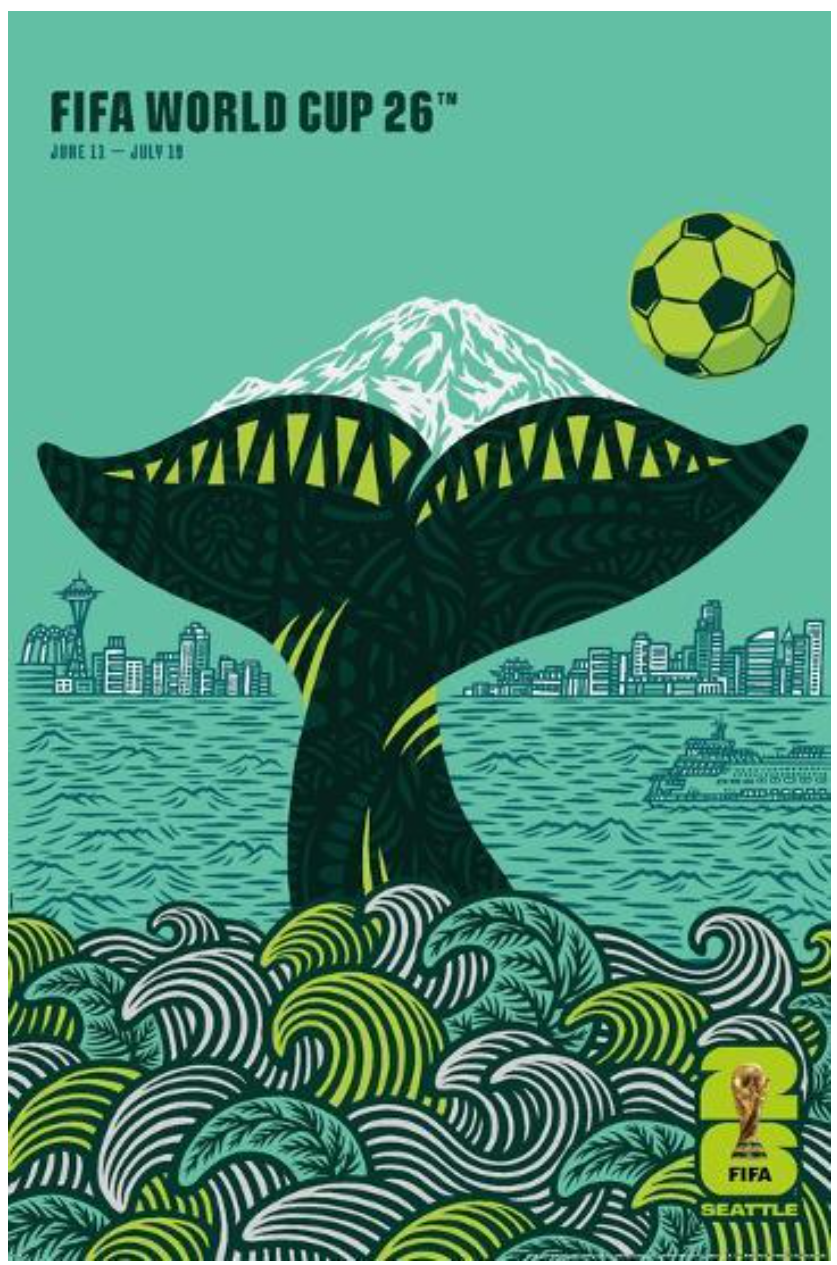
Official Seattle World Cup Poster by Shogo Ota. Source
“Seattle Stadium is positioned to be the most accessible venue in the FIFA World Cup 2026. Whether you're a local, or a visitor arriving from across the globe, getting to the match can be one of the best parts of the experience — no car required” says Peter Tomozawa, CEO of SeattleFWC26. Mr. Tomozawa is correct. Seattle earns its place at the top of this ranking by virtue of a stadium that stayed in the city, a transit network built across forty years through repeated acts of democratic commitment, and a host committee willing to make the most aggressive demand management choices of any US venue.
Stadium
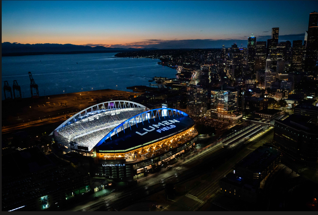
Lumen field in the evening. Photo from bing
Lumen Field — known at various points as Seahawks Stadium, Qwest Field, and CenturyLink Field — occupies the same SoDo industrial district where the Kingdome stood from 1976 until its implosion in March 2000. The site itself tells Seattle's industrial story: SoDo was built on filled-in tidal flats, a mishmash ever since of rail yards and sawmills, meat packers and metal shops, a seaport, warehouses, and a Hooverville during the Depression, land that was available, underutilized, and cheap enough to site a publicly funded stadium without displacing an established residential community. The Kingdome, financed by a 1968 King County bond measure, served as the multipurpose home of the Seahawks, Mariners, and briefly the SuperSonics for more than two decades before structural and financial problems caught up with it. A 1994 ceiling tile collapse during a Mariners game (no one was killed, but the near-miss required $70 million in emergency repairs) accelerated demands from both tenants for purpose-built replacements. When then-owner Ken Behring attempted to relocate the Seahawks to Los Angeles in 1996, the NFL blocked the move, opening the door for Paul Allen to purchase the team on the condition that a new stadium be built. Allen championed a statewide referendum rather than a purely local vote, and Referendum 48 passed narrowly in June 1997 — 51.1% statewide, winning heavily in suburban Snohomish County and around Bellevue and Redmond, while losing in Seattle's most liberal precincts on Capitol Hill, Queen Anne, and Magnolia.
The resulting $430 million stadium is publicly owned by the Washington State Public Stadium Authority, funded by $300 million from lottery revenues, King County sales and hotel taxes, and parking and admission taxes, with $130 million from Allen's First & Goal Inc. — who also agreed to cover all cost overruns and contribute $10 million directly to neighborhood mitigation. The stadium's most significant distinction for this series is its transit access: Sound Transit's Link Light Rail Stadium Station is literally adjacent to the gates, delivering fans from downtown Seattle in five minutes and from SeaTac Airport in forty minutes with no transfers, making Lumen Field arguably the best-served World Cup venue in the entire tournament by public transit. Seattle is one of the only host cities where fans can walk, bike, take a bus, board a train, or arrive by ferry. There was never a serious discussion of moving the stadium to the suburbs — the SODO industrial corridor had been the city's stadium district since the Kingdome's founding, the land was already established for the use, and Paul Allen was a Seattle owner committed to keeping the team in the urban core. The stadium now houses not only the Seahawks but MLS's Seattle Sounders FC and NWSL's Seattle Reign, and the neighborhood that grew up around it took its name from the building: SODO — South of the Dome
Transit
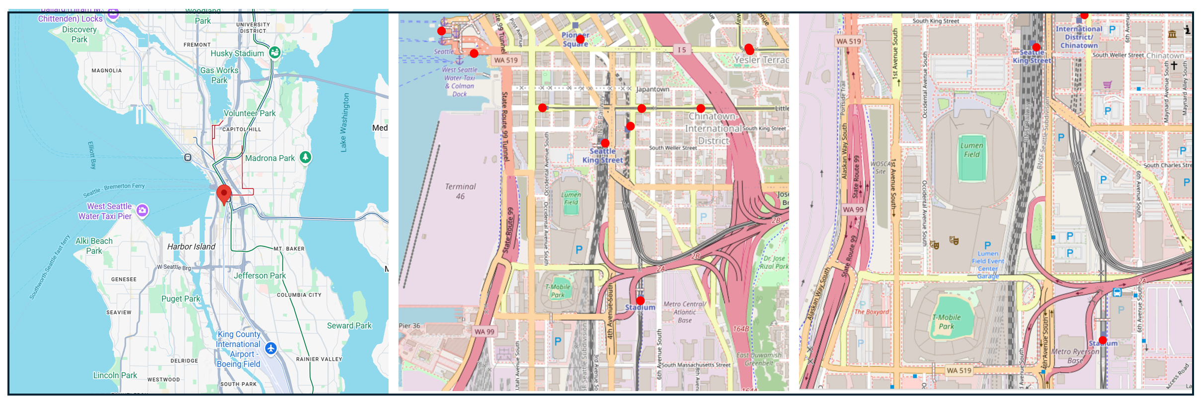
From left: Lumen Field regional overview view, the stadium with nearby transit stations, and close up with surrounding streets. Sources: Google Maps and the National Transit Station Atlas
Seattle's transit history is, in some respects, a story of a forty-year delay followed by one of the most sustained transit buildouts in the country. In 1968, King County voters approved the Forward Thrust ballot measure, which would have funded a $1.15 billion rapid transit network, one of the most ambitious urban rail proposals in postwar America. But the measure required a 60% supermajority statewide, and when it fell short in 1970 on a second try, the federal matching funds Congress had committed (roughly $385 million) were redirected to Atlanta and Baltimore instead. Seattle spent the following two decades in a transit planning wilderness of failed ballot measures and regional disagreements. Sound Transit was finally created in 1996, and voters approved the initial ST1 package the same year. Link Light Rail's first segment launched in 2009, with more than 30,000 first-day riders cheering from the platforms — with Stadium and International District stations deliberately sited to serve the sports complex.
What followed was a regional transit renaissance that accelerated with each successive ballot measure. Voters continued to support further investments, passing ST2 in 2008 and ST3 in 2016. The University Link extension, with new stations at Capitol Hill and Husky Stadium, opened in early 2016 ahead of schedule and approximately $150 million under budget — and ridership exploded, up 77 percent in summer 2016 compared to summer 2015, far exceeding forecasts. Northgate Link followed in 2021, extending the system deep into North Seattle. The 1 Line extended to Lynnwood in August 2024 and to Federal Way in December 2025; the 2 Line opened its initial Eastside segment in April 2024, extended to Downtown Redmond in May 2025, and completed its Crosslake Connection across Lake Washington in March 2026. The Link system now spans 63 miles and includes 50 stations — growing from a single 13-mile line the year Lumen Field hosted its first Seahawks game. ST3, approved in 2016, is still delivering: planned extensions to West Seattle, Ballard, Tacoma, and Everett will eventually make it one of the largest transit systems in the country. The lesson embedded in Lumen Field's transit access is partly one of civic redemption — the infrastructure that makes Seattle the best-served World Cup venue in the country was delayed by roughly forty years from when it could have existed — and partly one of democratic compounding: a region that kept voting yes, building on each prior investment, and is now reaping returns that the Forward Thrust generation could only have imagined.
Urban Fabric and Vitality
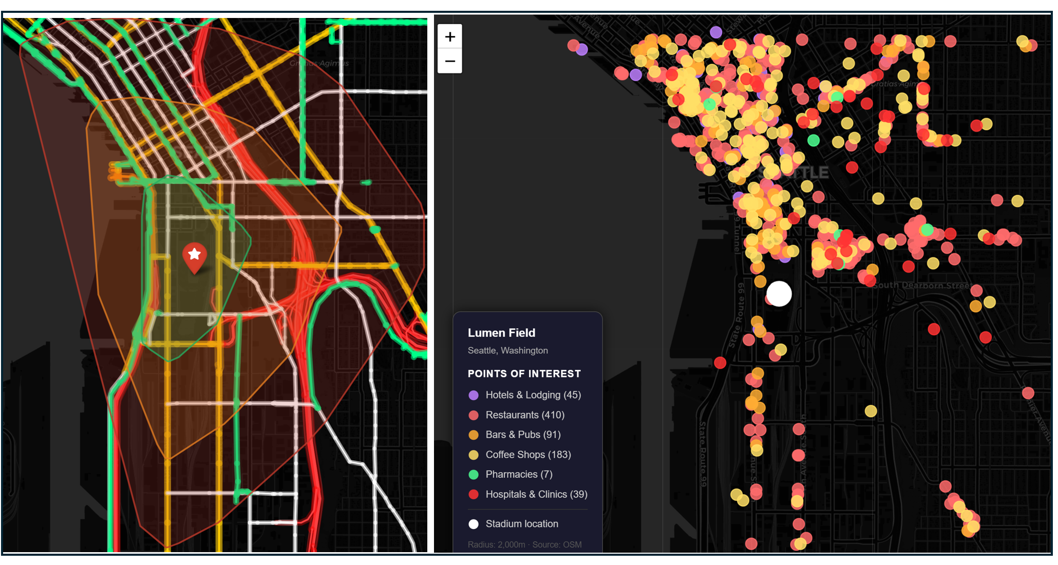
Left: Isochrone map showing a 10-, 20-, and 30-minute walk from the stadium. Highways shaded bright red, arterial roads shaded yellow and bike trails shaded green. Right: Hotels and game-day amenities within 30 minutes of the stadium.
SoDo and the surrounding neighborhoods offer ample opportunities for fans to arrive by walking, biking, and scootering, Fans planning to walk to the stadium from downtown should be able to make the trip in about 20 minutes and the walk from Pioneer Square and nearby locations should be easy and relatively pleasant (though some of the arterial roads leading to the stadium may be more welcoming to car traffic than pedestrians). The SoDo Trail — a mixed-use cycling and pedestrian path running along the light rail corridor — connects the stadium district to surrounding neighborhoods and provides an active transportation alternative to both driving and transit. Docked and dockless shared bikes and scooters are plentiful.
OpenStreetMap lists over 700 attractions, including 45 hotels, within a 30-minute walk of the stadium, most of which are clustered to the north and west. Lodging near the stadium provides more opportunity for fans to walk or bike to the game. The plethora of cafes, bars and restaurants give visitors the option of avoiding crowds and staggering their trip to and from the stadium by stopping at a place to eat first.
Parking and Demand Management
Seattle offers no official parking option whatsoever for World Cup fans arriving by car. This is partially in response to FIFA’s needs for a security perimeter, but it also reflects the City’s longstanding transportation management program, emphasis on traveling to the stadium by modes other than personal vehicles, and the fact that, unlike many of its suburban neighbors, stadium planners decided not to construct acres of parking around the field. On match days, rideshare services will also be geofenced away from Seattle Stadium to reduce congestion. Construction will pause in key areas from June 8 through July 6, clearing work zones from streets and sidewalks to maximize pedestrian space during the tournament. Pioneer Square will also become a pedestrian only zone on match days with surrounding streets blocked off from traffic.
Projected Attendance
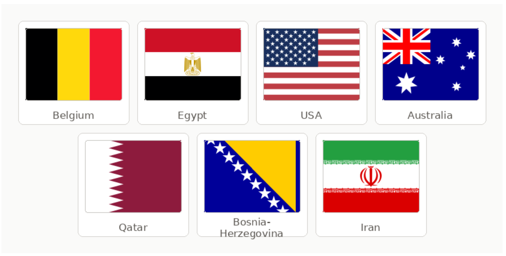
Lumen Field hosts 6 matches including the US men's national team vs. Australia, which may be the single most in-demand match for American fans outside of the Final. Confirmed nations are Belgium, Egypt, USA, Australia, Qatar, Bosnia-Herzegovina, Iran. The USA match will likely generate the highest domestic audience. Stadium capacity for the World Cup is approximately 68,740. Officials expect roughly 750,000 visitors to come through Seattle during the World Cup, with about 100,000 people in and around the stadium on match days. Cumulative attendance across six matches approaches 412,000 fans.
Downstream Effects
Transportation Investments
Sound transit plans to increase light rail frequency to every four minutes during match days with extended hours until 1 AM. Sound Transit will also add special Sounder commuter rail trains for each of the six matches, timed to arrive before kickoff with return trips about an hour after matches conclude. King County Metro plans to add 60 new bus routes on match days and 40 on non-match days, with customer support teams at key transit hubs and additional security along Third Avenue and at shuttle stops. The city is planning a free waterfront shuttle which connects Waterfront Park, Seattle Center, Pioneer Square, the Chinatown-International District, and Seattle Stadium and runs from May 31 through Labor Day. Seattle is also making significant pedestrian infrastructure investments: improved sidewalks, wheelchair ramps, and crosswalks near Lumen Field, Union Station, and Pioneer Square; better connections between downtown and the waterfront; a new sidewalk on 4th Avenue South improving access between SoDo and downtown. Unlike in many other World Cup cities where transportation investments are needed to patch preexisting infrastructure gaps or provided solely for the benefit of World Cup visitors, these changes enhance an already strong transit network and can be enjoyed by all.
Game Day Crowding and Safety
Any day that includes 100,000 people in close quarters runs the risk of traffic or pedestrian choke points, but Seattle’s plans for a car-free experience, combined with a variety of options from getting to and from the game lower the risk that drivers or pedestrians will encounter overcrowded train stations, platforms, or intersections. The area’s many restaurants, bars, and attractions give fans an incentive to arrive early and avoid a crush into the stadium. The distributed transit network allows pedestrians to access multiple stations when leaving the stadium. And the relatively walkable street grid and the stadium’s close proximity to Downtown offer fans a “plan B” of walking home should trains become too crowded.
Fan Travel Time and Cost
Lumen Field’s city location provides the shortest travel time of any World Cup city for fans staying in Downtown or the Pioneer Square fan area. It’s a 5-10 minute trip from Downtown by light rail or 10-15 minutes by foot. Light rail fares are $3 one-way or $6 for a day pass. Visitors can purchase a three-day transit pass for $21 — covering unlimited rides across the Sound Transit network including Link light rail and ST Express buses.
Impact on Regular Transit Riders
The impact is largely positive. Sound Transit’s plan to increase light rail frequency and span of service during match days benefits everyone using the system, not just World Cup fans. The construction pause clears sidewalks and reduces work zones throughout the tournament footprint. The free waterfront shuttle adds a new mobility option for Seattle residents through Labor Day, outlasting the tournament itself.
The negatives include match-day crowding and Pioneer Square street closures, which will temporarily relocate buses and will prevent the Seattle Streetcar First Hill Line from serving the Pioneer Square stop. For regular commuters routing through Pioneer Square on match days, this is a real disruption.
Cost to Public Agencies and the Taxpayer
Seattle’s primary transit providers, Sound Transit, King County Metro, and Washington State ferries, all face higher marginal costs associated with increasing service during the World Cup. An itemized cost breakout is not available, and true costs may not be known until after the World Cup has ended, but investments to date suggest the extra transportation costs are low relative to other cities. Washington State has provided $9 million to cover increased transit operations costs. A private sector consortium is funding the summer ferry service. The Federal Transit Administration has also provided $8.4 million to offset local expenses (an amount based on the number of games and stadium seats, not necessarily the costs associated with World Cup service).
Carbon Footprint
Low. The increased amount of tailpipe emissions associated with 750,000 people descending on Seattle for a month are not zero, but Seattle’s World Cup approach comes the closest of any of the American World Cup cities to a “carbon free” ideal. City officials have set a goal that 80% of fans arrive at the stadium without a personal vehicle. Unlike other cities which allow for stadium parking, encourage rideshare, and are contracting to add hundreds of additional buses to provide needed transportation, Seattle has eliminated stadium parking, is discouraging rideshare, and is relying on existing transit infrastructure, a mixture of electric, gas and diesel vehicles, along with its extensive bike and pedestrian network.
#2: Atlanta
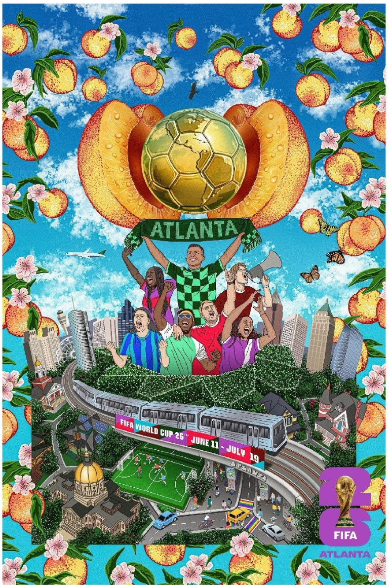
Official Atlanta World Cup Poster by José Hadathy. Source
Atlanta's second-place ranking deserves a double reckoning, marking what the city got right and with what it destroyed to get there. As is the case with Seattle, fans are poised to save time and money with a transit accessible downtown stadium in a walkable area. What most fans won’t be aware of is the particular racial politics of sports infrastructure that built sports arenas where Black churches once stood.
Stadium
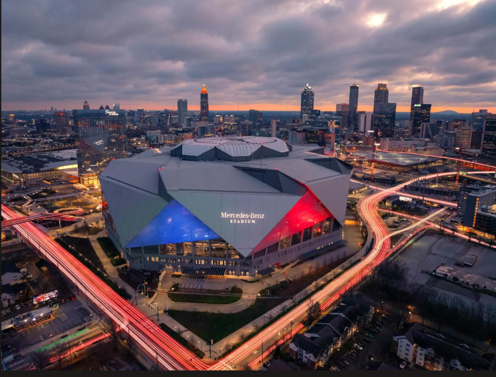
Mercedes-Benz Stadium. Image from bing
Mercedes-Benz Stadium opened in August 2017, replacing the adjacent Georgia Dome that had stood since 1992 — but the site's history of displacement begins three decades earlier. The stadium complex is located in the Lightning neighborhood, one of Atlanta's earliest Black communities, just west of downtown. Despite being surrounded by prestigious institutions — Georgia Tech, the Atlanta University Center — it was among the last areas in the city to get paved roads and electricity, and a slow pattern of disinvestment through the 1970s and '80s left it visibly blighted, making it an easier target when the State of Georgia selected the land for the Georgia Dome in the late 1980s. Officials failed to consult the community, and it soon became evident that construction would demolish or displace nearly a dozen historically Black churches in the area. A group of Black clergy organized opposition, and as a result of their efforts, the state agreed to pay $25 million to residents, businesses, and churches for relocating — a partial victory at best, as the neighborhood itself was still erased entirely. The Georgia Dome, financed through tax-exempt bonds and a 2.75% hotel/motel tax, opened in 1992 at a cost of $214 million, partly driven by threats from Falcons owner Rankin Smith to relocate the franchise. The homes of Lightning became parking lots.
Those parking lots then became the site of Mercedes-Benz Stadium — the physical residue of one displacement layer now buried beneath another. When Falcons owner Arthur Blank began pursuing a replacement for the aging Georgia Dome in the early 2010s, a suburban move was explicitly on the table: Falcons CEO Rich McKay told the Atlanta City Council that if a downtown deal couldn't be reached, the team would explore sites elsewhere in the metro area, with Gwinnett County specifically mentioned as an alternative. What kept the Falcons in the city was Blank's own preference — he wanted to stay in Atlanta proper — at a moment when the city's baseball team was making the opposite choice: the Braves simultaneously abandoned Turner Field for a new stadium in suburban Cobb County,. The displacement pattern also repeated itself in the new stadium's construction: building Mercedes-Benz Stadium required the demolition of two more of Atlanta's oldest Black churches, Friendship Baptist and Mount Vernon Baptist, for a combined $34 million — the latest installment in a decades-long pattern of clearing sacred community institutions in pursuit of Atlanta's sports ambitions. Under pressure from the community, the Atlanta City Council approved a community benefits agreement in 2013 committing to job training, health programs, economic development, and affordable housing preservation in the surrounding neighborhoods. The $1.5 billion stadium — funded with $200 million in publicly backed bonds, the hotel-motel tax extended through 2050, and the remainder from Blank's AMB Group — is home to both the Atlanta Falcons and Atlanta United FC, and has hosted two Super Bowls. The history of Lightning exists mostly in the memories of those who called it home.
Transit
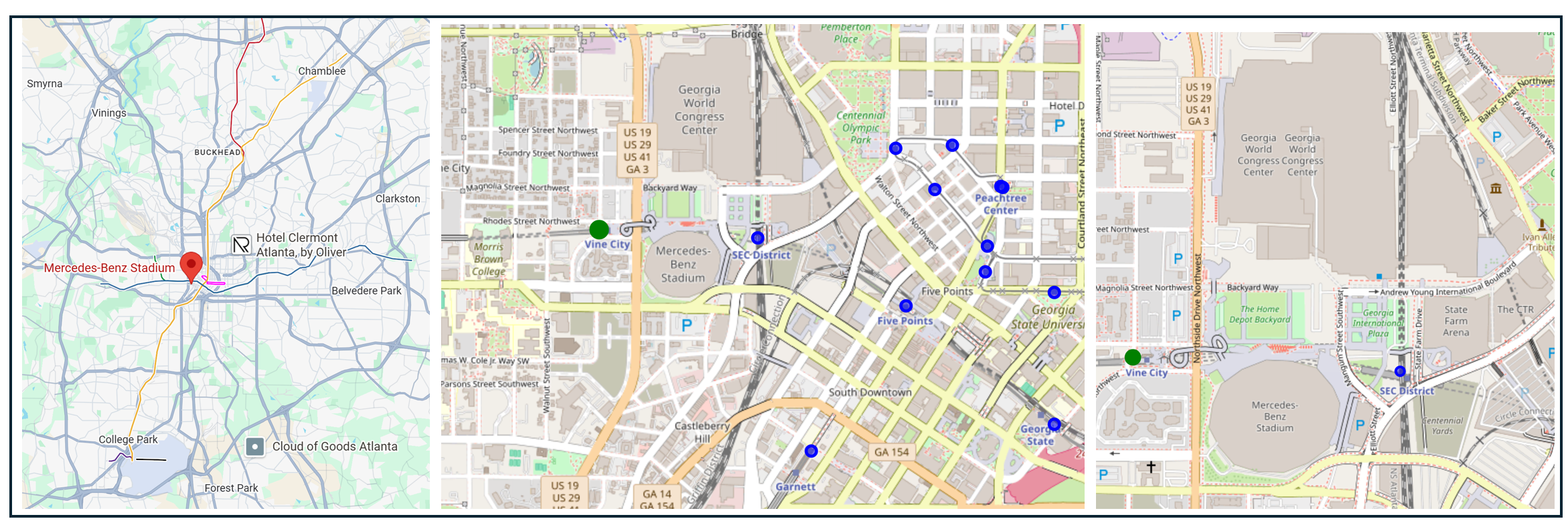
From left: Stadium location regional overview, the stadium with nearby transit stations, and close up with surrounding streets. Sources: Google Maps and the National Transit Station Atlas
MARTA's origins in 1965 were regional in ambition but became urban almost by political design. When the agency was created, the vision included the entire Atlanta metro: Fulton, DeKalb, Cobb, Gwinnett, and Clayton counties. Cobb and Gwinnett refused to participate, a decision widely understood, then and now, as suburban white resistance to connecting predominantly white suburban communities to a majority-Black city. (The racist backronym "Moving Africans Rapidly Through Atlanta" crystallized the sentiment.) The consequence was a system confined to two counties, funded solely by a local sales tax with no state contribution, a structural funding disadvantage Georgia has never corrected. Rail service began in 1979 and was extended to serve what is now the Mercedes-Benz Stadium footprint as part of the original network buildout, which is why the stadium has two stations with pedestrian infrastructure rather than an afterthought shuttle.
Vine City Station on the Blue/Green Line, a 2-minute walk to the stadium's west gates, and SEC District Station (formerly GWCC/CNN Center), connected to the stadium's east side by a covered pedestrian bridge directly to Gate 4. MARTA's Red and Gold Lines both serve the stadium directly, sharing the same trunk through Downtown Atlanta, meaning that fans from the northern suburbs, from Buckhead, from Midtown, and from Hartsfield-Jackson Airport can all reach the stadium on a single train with at most one transfer at Five Points.
Urban Fabric and Vitality
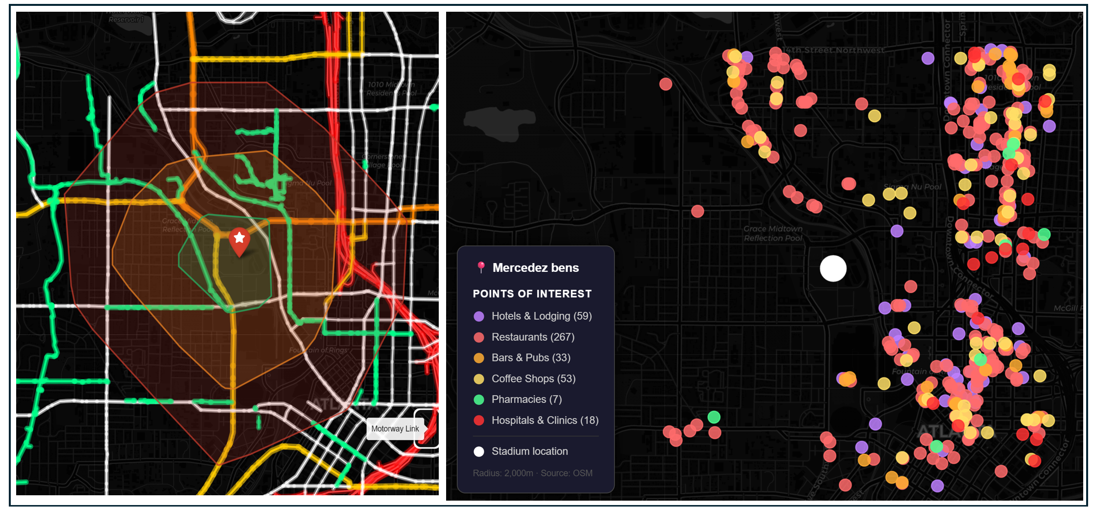
Left: Isochrone map showing a 10-, 20-, and 30-minute walk from the stadium. Highways shaded bright red, arterial roads shaded yellow and bike trails shaded green. Right: Hotels and game-day amenities within 30 minutes of the stadium.
Atlanta Stadium is within a 30-minute walk from all directions, though fans traveling from the east may need to walk over I-75 and the train tracks. Bike infrastructure is also in place connecting multiple neighborhoods to the stadium. A $33 million pedestrian bridge connecting Vine City MARTA Station to the northwest side of the stadium and the Home Depot Backyard was completed in 2019, allowing pedestrians to avoid crossing six-lane Northside Drive.
The eastern face of the stadium opens onto a culturally rich destination cluster with ample opportunity for fans to stay within walking distance of the stadium or to stagger their arrival and departure. However, only a handful of the 430 points of interest within a 30-minute walk of the stadium are located in neighborhoods directly to the west, hinting that the forces of neighborhood disinvestment that shaped the politics of the facility construction remain present today.
Parking and Demand Management
Mercedes Benz Stadium’s website states there are more than 20,000 parking spots available within a 20-minute walk of the stadium (including stadium lots, privately owned lots, and adjacent downtown lots and garages) however it is not clear how many of these spots will be available for World Cup fans. Recently published parking prices for Atlanta matches are roughly $100–$235 per vehicle, depending on the match and location. Organizers are communicating transit is the easiest and cheapest option while making driving inconvenient and expensive. They have not announced a cap on game day parking or special financial incentives for transit riders.
Projected Attendance
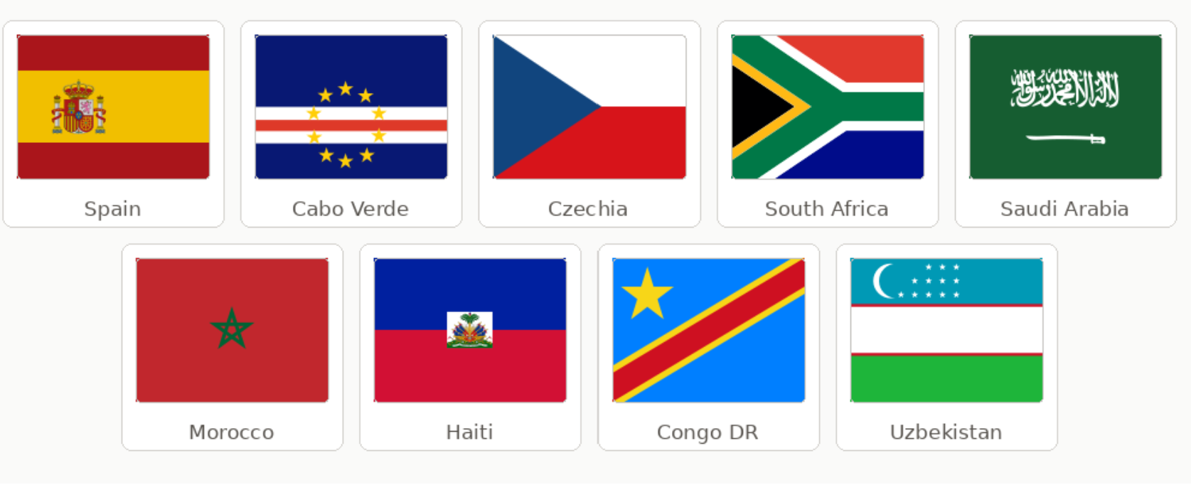
Atlanta hosts 8 matches — tied with MetLife for the most of any venue — including the tournament's third most prestigious fixture: the Semi-Final on July 15. Confirmed nations include Spain (playing twice in group stage), Morocco, and South Africa. Stadium capacity for the World Cup is approximately 71,000–75,000. Atlanta expects approximately half a million visitors across its eight matches. Cumulative attendance approaches 560,000 fans.
Downstream Effects
Transportation Investments
As is the case with Seattle, Atlanta’s plan is to count on and augment their existing public transportation network rather than create new services from scratch. On match days, MARTA will increase rail services to five-minute headways, add pre-game shuttle trains between Five Points and GWCC stations, position buses and vans at key stations to mitigate potential service disruptions.
MARTA has also invested in longer-term transit enhancements that are timed to be implemented around the World Cup. These enhancements include new rail cars, a bus network redesign, a new bus rapid transit route, station rehabilitation, and fare payment modernization.
Game Day Crowding and Safety
The presence of two separate MARTA stations near the stadium along with walkable neighborhoods on all sides of the stadium, and intermediary destinations for fans to stagger their trip lower the risk that drivers or pedestrians will encounter overcrowded train stations, platforms, or intersections.
Fan Travel Time and Cost
From Downtown hotels: 5–20 minutes by foot or one MARTA stop. From Midtown (Peachtree Street corridor): approximately 10–15 minutes by rail. From Buckhead: approximately 18 minutes on the Gold Line. $2.50 each way from anywhere in the Atlanta metro area
Impact on Regular Transit Riders
MARTA imposes no restrictions on regular commuters on match days and match-day transit enhancements are additions to existing service. Regular Atlanta commuters, airport travelers, and visitors using the system on match days will experience more frequent trains and more staffing, net positive effects at no additional cost to them.
Cost to Public Agencies and the Taxpayer
Atlanta officials have not publicly released a precise per-game operating-cost estimate for World Cup transit service. However, MARTA has acknowledged incremental expenses tied to extra rail operations, five-minute match-day frequencies, station staffing, transit ambassadors, and police overtime. The Federal Transit Administration has provided $9.4 million to Atlanta transit agencies for World Cup related operating expenses.
Carbon Footprint
Atlanta and Seattle have taken similar sustainability approaches, but Atlanta organizers have not announced any parking restrictions, likely leading to thousands of fans driving to the game and more tailpipe emissions associated with the World Cup in Atlanta than in Seattle.
#3: Houston
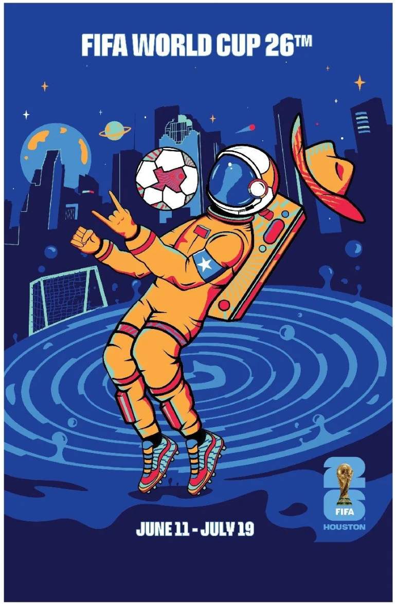
Official Houston World Cup Poster by Stephanie Leal. Source
Wait what, Houston? Ranked #3? Houston's top-tier ranking is the most counterintuitive result in this survey. The city that spent most of the twentieth century as the capital of American car-dependence also built a transit accessible stadium with nearby bike and pedestrian trails and mixed-use development. It’s a reminder that transit investments and urbanism aren’t relegated to America’s older cities in the northeast. Still, with no parking restrictions, I suspect there will be plenty of cars on the road and around the stadium.
Stadium
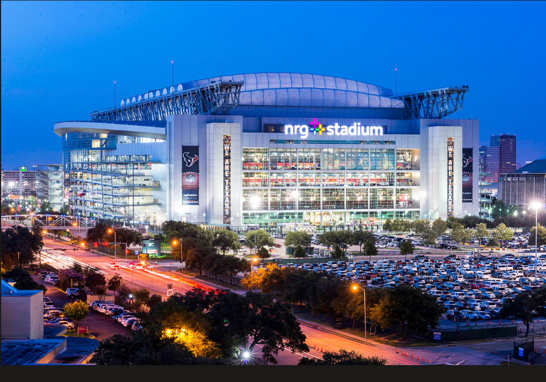
NRG stadium. Image from bing
NRG Stadium sits within a 350-acre Harris County sports and entertainment campus that has been accumulating institutions since 1965, when the Astrodome, the world's first multipurpose domed stadium, billed as the "Eighth Wonder of the World", opened on what had been undeveloped land on Houston's southwestern fringe, assembled from a 494-acre parcel purchased from the Hilton corporation for $2.5 million. By the 1980s, however, Houston Oilers owner Bud Adams had grown dissatisfied with the stadium’s aging amenities and relatively modest capacity. By the early 1990s Adams was demanding an entirely new domed stadium located downtown. He offered $85 million toward construction in 1993, but Houston Mayor Bob Lanier refused to commit any public money, and voters rejected a stadium referendum. Nashville offered Adams what Houston wouldn't, and after the 1996 season the Oilers departed for Tennessee, eventually becoming the Titans. Downtown Houston did eventually get its new stadium — but for baseball. The Astros opened what is now Daikin Park near Union Station in 2000.
When Houston was awarded an NFL expansion franchise in 1999, the new ownership group made a pragmatic choice: rather than revive the bruising politics of a downtown site, they partnered with the Houston Livestock Show and Rodeo and built adjacent to the existing Astrodome complex on land Harris County already controlled.
NRG Stadium is not an urban stadium in any conventional sense — it sits six miles south of downtown Houston, surrounded by highways and parking — but its site story is meaningfully different from the other car-dependent venues in this series: no neighborhood was cleared, no community was displaced, and the decision to build here was driven by institutional continuity rather than suburban flight.
Transit
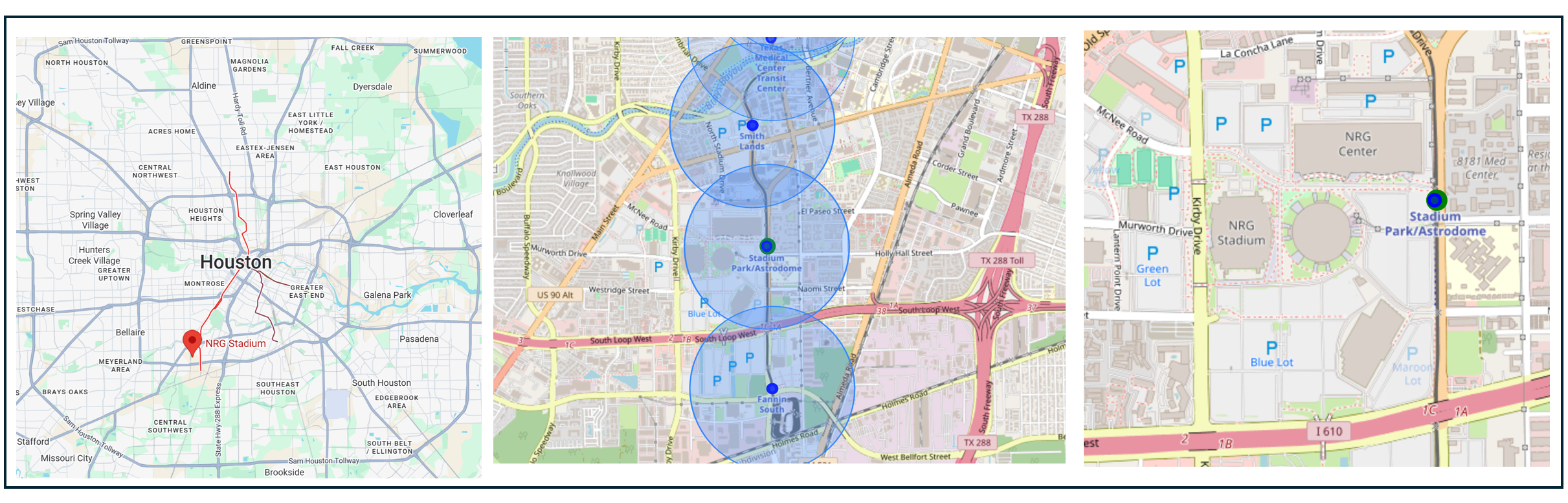
From left: stadium location regional overview, stadium with nearby transit stops (blue circles indicate a ½ mile radius around the station) and closeup of the stadium and surrounding area.
Houston spent most of the twentieth century as the ideological capital of American car-dependence — no zoning, low density, a highway network that consumed the city, and a political culture that treated transit as an unnecessary cost or a socialist imposition. The city's voters rejected a rail proposal in 1973 and effectively tabled the conversation for three decades. METRORail's Red Line, which opened in January 2004, was Houston's first light rail — and it was controversial even then, with critics arguing that a city of Houston's density and layout couldn't support rail. The Red Line was routed along Main Street through Midtown and the Museum District to the Texas Medical Center, and its southern terminus at the NRG campus — the site of the World Cup stadium — was a deliberate choice to serve the existing stadiums complex. The Red Line's success has been one of the quiet vindications of American transit planning: it routinely outperforms ridership projections and carried meaningful crowds long before the World Cup was awarded. Houston's transit story is less one of political failure than of delayed conversion — a deeply car-dependent city that finally built one good rail line, pointed it at the right destination, and is now reaping the benefit.
Urban Fabric and Vitality
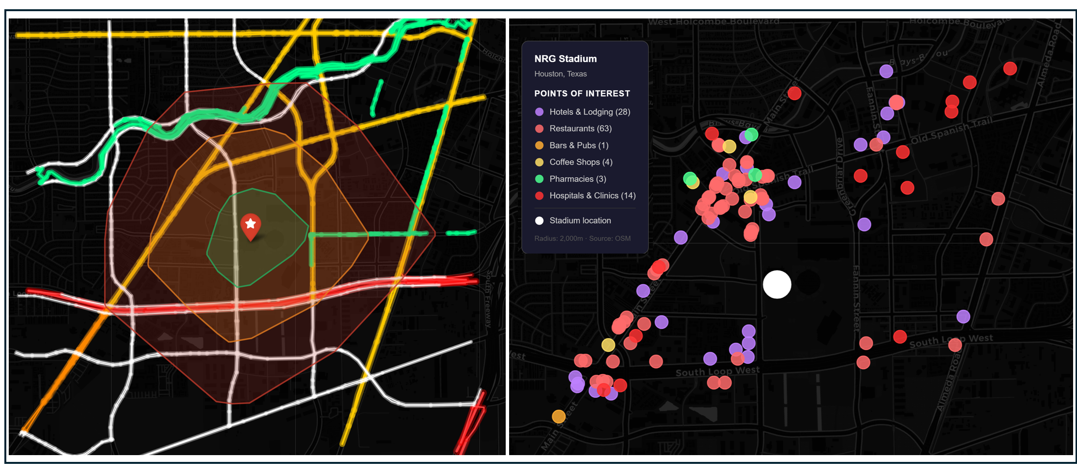
Left: Isochrone map showing a 10-, 20-, and 30-minute walk from the stadium. Highways shaded bright red, arterial roads shaded yellow and bike trails shaded green. Right: Hotels and game-day amenities within 30 minutes of the stadium.
The NRG complex itself is an events campus, not a mixed-use neighborhood. But the adjacent geography is walkable, bikeable and urban. Fans can walk to NRG stadium from all directions within 30 minutes, though fans coming from the South will need to walk under Interstate 610. The walkshed includes the Green Corridor a network of shaded pedestrian and cycling trails, water stations. The 28 hotels listed in OpenStreetMap are located on all sides of the sports complex, creating easy opportunities to walk to the game. A cluster of attractions located around the intersections of Main Street, the Old Spanish Trail, and Kirby Drive are an option for fans who want to stagger their arrival or departure.
Parking and Demand Management
NRG Park offers one of the largest parking areas in the country, with over 26,000 spaces available. As is the case with Atlanta, Houston’s organizers have not announced a maximum number of spaces that will be available for people driving to the game. Stadium parking fees are expected to range from $100 to $175. Houston organizers are communicating infrastructure investments and transit service enhancements as incentives for people to take transit to matches.
Projected Attendance
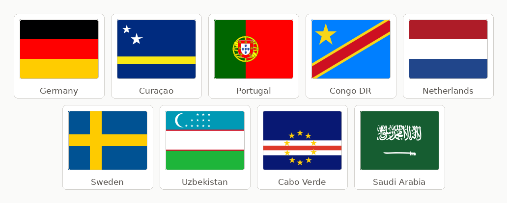
Houston hosts 7 matches at NRG Stadium across Groups E, F, H, and K, plus a Round of 32 and a Round of 16 on July 4 — US Independence Day. Three top-10 FIFA-ranked nations play in Houston: Germany (ranked 9th), the Netherlands (7th), and Portugal (6th). Portugal plays twice. Stadium capacity is 72,220, giving a total cumulative attendance approaching 506,000 fans across 7 matches.
Downstream Effects
Transportation Investments
As is the case with Seattle and Atlanta, Houston is expanding its conventional transit service rather than investing in brand new services, although some suburban transit will go far above and beyond what is typical. Metro is planning for 6-minute Red Line frequency during the 4-hour window before kickoff and the 2-hour window after the final whistle. Two-car trains will be deployed on the Red Line. Bus routes will have increased frequency to several entertainment districts, park and ride lot services will expand, and standby buses will be placed near NRG Park and downtown to replace or supplement the Red Line train if the rail service experiences interruptions or overcrowding.
Meanwhile, the Houston-Galveston area Council is funding suburban shuttle connections through the Woodlands Soccer Shuttle — connecting The Woodlands area to NRG Stadium on all seven match days. The city of Conroe announced shuttle service from Conroe to NRG Stadium using existing transit resources at no additional cost to taxpayers.
Game Day Crowding and Safety
Although most fans taking transit to the game will use the Red Line’s Stadium Park/Astrodome Station, the presence of the Smith Land Station located ½ mile to the north on the Red Line gives fans a second travel option. The area’s walkable street grid, bike infrastructure, and many destinations near the game may also help relieve crowding on the Red Line.
Fan Travel Time and Cost
The Red Line delivers fans from Downtown Houston to the stadium in approximately 21 minutes for $1.25. From the Museum District: ~10 minutes. From Midtown: ~15 minutes. From EaDo via the Green/Purple Lines with a downtown transfer: approximately 30–40 minutes. These are among the fastest transit travel times of any World Cup venue in our study.
Impact on Regular Transit Riders
The 106,000 daily workers in the Texas Medical Center — nurses, doctors, researchers, support staff — will experience faster, more frequent trains for five straight weeks. Students at Rice University and the University of Houston will benefit from extended late-night service. Residents of Third Ward, EaDo, and the Museum District neighborhoods along all three rail lines will ride better transit throughout the tournament period.
Cost to Public Agencies and the Taxpayer
Houston METRO has committed $10 million in service upgrades specifically for the World Cup tournament window. FTA is providing $9.1 million in support for transit operations.
Carbon Footprint
Medium. Houston’s carbon footprint may be similar to Atlanta’s: The host city provides a strong emphasis on and opportunity to rely on transit and walking while, at the same time, putting no restrictions on game day driving and parking. The regional shuttle serves from outlying areas in the region contribute additional tailpipe emissions.
#4: Philadelphia
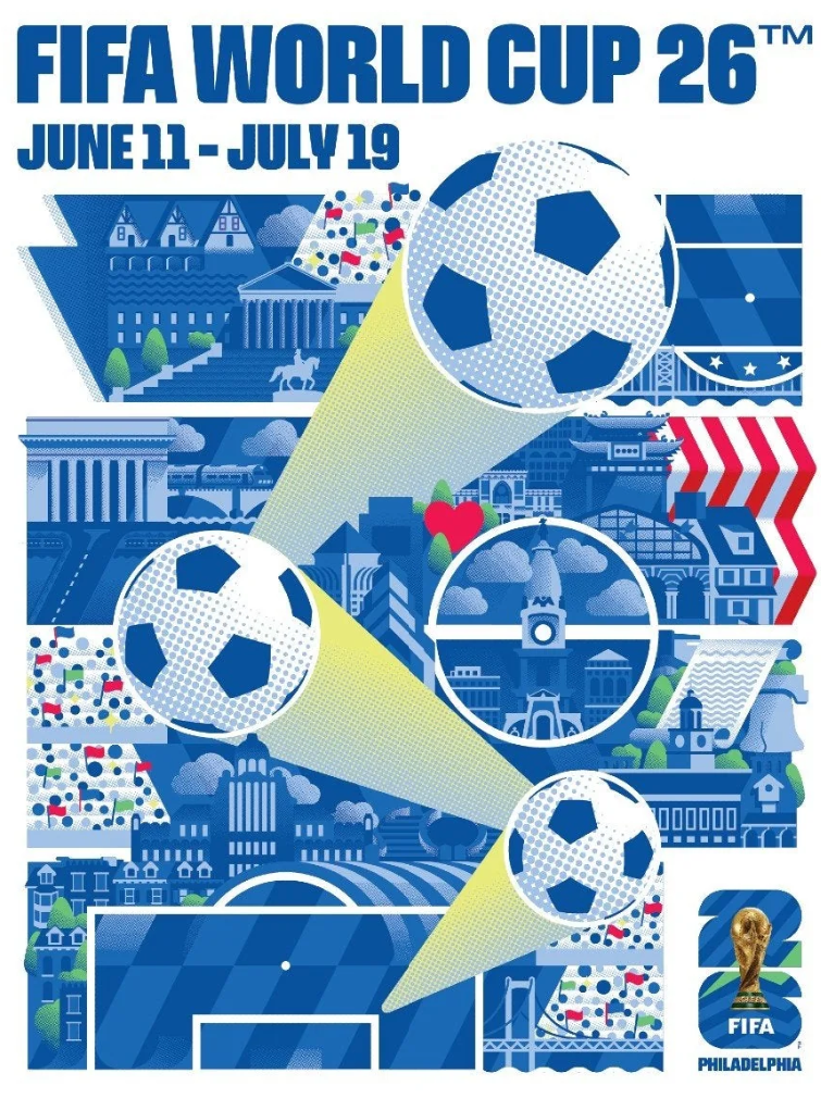
Official Philadelphia World Cup Poster by Nick McClintock. Source
Philadelphia is the last host city with an urban stadium, and this one is barely within the city limits. There’s a real tension between the desire to have a stadium that caters to the City of Brotherly Love and its time-tested transit system, and the need to acknowledge that New Jersey exists and many of its residents travel by car. The result is a tie game between urbanist and non-urbanist priorities, which places Philadelphia towards the middle of the pack.
Stadium
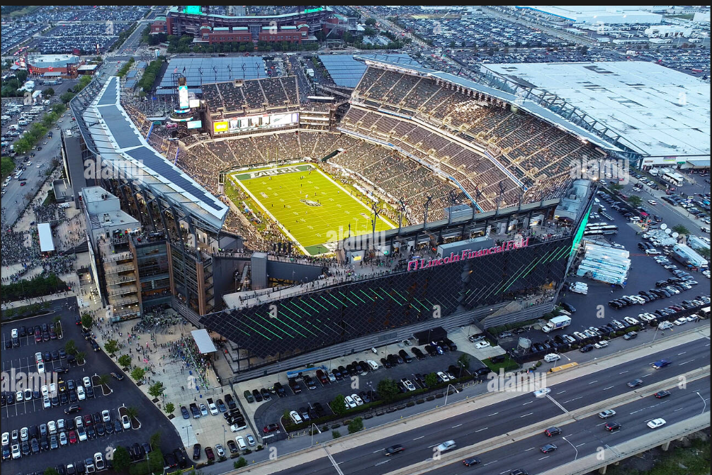
Lincoln Financial Field. Image from bing
Lincoln Financial Field opened in August 2003 on the same South Philadelphia site where Veterans Stadium had stood since 1971, continuing an unbroken sixty-year commitment to concentrating Philadelphia's professional sports in a single highway-adjacent complex four miles south of City Hall. The Eagles' earlier homes were woven into the city's urban fabric: Baker Bowl and Connie Mack Stadium sat at 21st and Lehigh in a dense North Philadelphia neighborhood served by transit, and Franklin Field occupied Penn's campus in West Philadelphia, where the Eagles played from 1958 to 1970 in a genuinely walkable, transit-adjacent setting. The departure from Connie Mack was itself driven in part by white flight: as white residents left for the suburbs, the surrounding area suffered from high rates of poverty and racial segregation, and fans' increased reliance on cars created massive parking problems — making the stadium feel, to suburban fans, like a place to be avoided. Veterans Stadium's 1971 opening at a highway interchange in South Philadelphia was the resolution of that discomfort: a purpose-built car-centric complex designed, as the Encyclopedia of Greater Philadelphia explicitly notes, to serve suburban fans reliant on the automobile rather than urban residents on transit. Lincoln Financial Field, which cost $512 million with roughly $188 million in public funds from the city and state, extended this geography.
As with NRG field in Houston, the South Philadelphia complex is a hybrid of car-centric design and urban location with good transit access. A suburban move has never been seriously pursued — the complex represents a settled civic commitment stretching back five decades, and successive owners have stayed put through multiple stadium cycles.
Transit
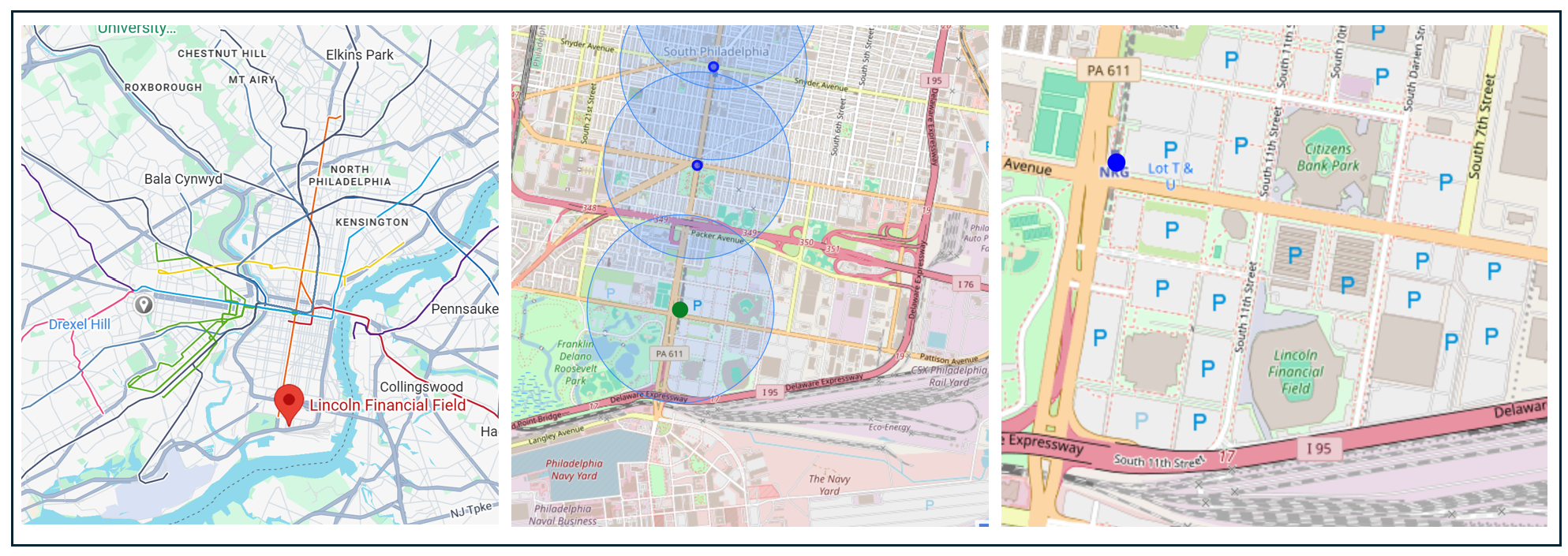
From left: Stadium location regional overview, stadium and nearby transit stations (the blue circles represent a ½ mile radius around each station) and closeup of the stadium and surrounding streets.
Philadelphia has one of the oldest and most extensive transit networks in the United States, with roots in the nineteenth century and a subway system that has run continuously since the early twentieth. The Broad Street Line, which will carry most World Cup fans to Lincoln Financial Field, dates to 1928 and runs the length of the city's main north-south spine. Its extension south to what is now NRG Station — serving the South Philadelphia Sports Complex — opened in 1973, two years after Veterans Stadium. That timing was not coincidental: the transit extension and the stadium were planned in tandem, an unusual act of coordinated infrastructure investment that treated transit access as an integral element of the sports complex rather than an afterthought. The result is the only World Cup stadium in this study where the rail infrastructure was purpose-built with the venue it serves, and where that infrastructure has been running daily — not just for events — for more than fifty years.
The Broad Street Line runs every day of the year, every 12–15 minutes during normal hours, not just for events. It connects the sports complex to City Hall in roughly 14 minutes, to Temple University in 20 minutes, to Fern Rock in the north, and via transfers to every part of Philadelphia's transit network. SEPTA regularly operates special "Sports Express" trains before and after large events, running non-stop between NRG Station and Walnut-Locust station in Center City. The station has an unusually wide and long island platform, built specifically to accommodate crush capacity crowds after events at the Sports Complex.
Urban Fabric and Vitality
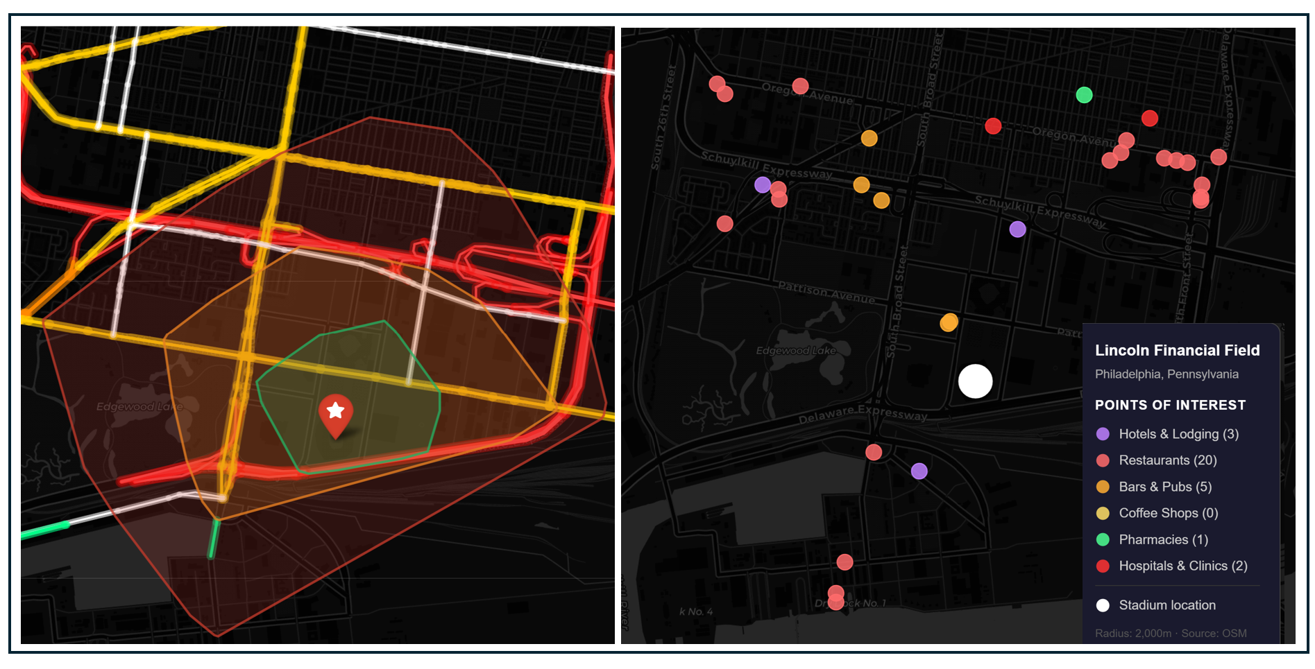
Left: Isochrone map showing a 10-, 20-, and 30-minute walk from the stadium. Highways shaded bright red, arterial roads shaded yellow and bike trails shaded green. Right: Hotels and game-day amenities within 30 minutes of the stadium.
The South Philadelphia Sports Complex is surrounded by hostile infrastructure. Working clockwise from the south: I-95 runs along the stadium's southern edge, separating the complex from the Delaware riverfront and the Navy Yard beyond it. To the west and northwest, I-76 (the Schuylkill Expressway) has its Packer Avenue exit (Exit 350) at the stadium's western edge and its Sports Complex exit (Exit 349) at the northwest corner — meaning the highway system essentially wraps around two sides of the property. FDR Park occupies the land between the complex and the Schuylkill River on the west, which is open parkland rather than commercial or residential fabric. The only genuinely open direction is north and northeast — toward the South Philadelphia row house neighborhoods across Oregon Avenue — and even those require crossing the parking lot landscape of the complex itself before you hit anything resembling a street grid.
OpenStreetMap lists 32 destinations within a 30-minute walk of the stadium, far fewer than in any of the host cities so far.
While some fans may choose to get off at the Oregon Station and walk about a mile tot he stadium, most fans taking transit will travel all the way to the NRG station, and the constrained walkshed and lack of nearby amenities mean that relatively few people are likely to walk or bike to the matches.
Parking and Demand Management
The South Philadelphia Sports Complex offers around 21,000 parking spaces, with approximately 2,000 at Lincoln Financial Field itself. The remaining car parks are spread across the complex and are within walking distance of the stadium. Official rates for Lincoln Financial Field are listed as about $115 for group-stage matches and around $145 for the Round of 16. Aside from noting that an undisclosed number of spaces in “Lot K” will be restricted during game days, organizers have not specified a maximum number of available parking spaces.
Philadelphia has the most innovative transit incentive program of any venue in our study. Airbnb — a FIFA tournament partner — has partnered with Philadelphia Soccer 2026 to provide free rides home on the Broad Street Line after all six World Cup matches. Free rides from NRG Station begin at halftime and continue for two hours following the end of each match.
Projected Attendance
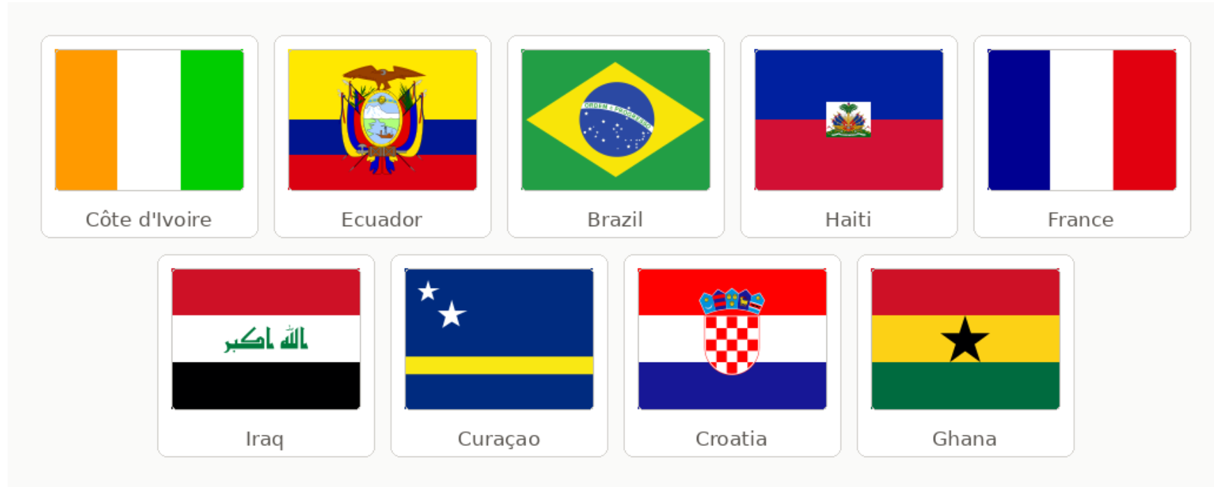
Philadelphia hosts 6 matches across four groups, including a Round of 16 on July 4 coinciding with America's 250th birthday celebrations. The featured nations — Brazil, France, Ivory Coast, Croatia, Ghana, Ecuador, Haiti, Curaçao — include two former World Cup champions playing group stage matches (Brazil and France), giving Philadelphia some of the most marquee group fixtures of any US venue. Stadium capacity is approximately 69,176. Cumulative attendance across six matches approaches 415,000 fans.
Downstream Effects
Transportation Investments
SEPTA will run Sports Express trains — a service it deploys for Eagles, Phillies, Flyers, and Sixers games — with increased frequency during the World Cup. The transit infrastructure already exists, at full operating capacity, serving the stadium every day of the year before the World Cup begins. The transit access requires no workaround because the transit access was built as part of the original complex, as the permanent southern anchor of the city's main subway line. SEPTA will also operate increased service on the B1 and B2 lines on game days
Game Day Crowding and Safety
Although the stadium’s surrounding land uses and transportation do not provide much of a “relief valve” for taking transit or driving, SEPTA’s existing transit capacity routinely handles post-game crush loads. Heavy rail transit is designed to carry greater volumes of people than most light rail systems and the World Cup's six match days will not be operationally unprecedented for SEPTA.
Fan Travel Time and Cost
From City Hall/Broad Street Station: approximately 14–15 minutes by subway. From Temple University area: approximately 20 minutes. The fare is $2.90 each way, $0 for the return trip (Airbnb-sponsored). In absolute terms, a round trip to a World Cup match in Philadelphia costs $2.90, essentially tied with Houston ($2.50)
Impact on Regular Transit Riders
There are no planned service restrictions, no diversions, no lockouts. Regular commuters along the Broad Street Line will experience more frequent trains — a net positive — and some additional crowding at transfer points in Center City.
Cost to Public Agencies and the Taxpayer
SEPTA says it will spend $18 million for overtime for transit operators and Transit Police, cleaning expenses, longer customer service hours and ambassadors to help people navigate the system. $1 million will be spent on safety and security, for portable surveillance equipment and a communications system to send police where they're needed most. $825,000 will be spent on signage, including World Cup branded signage, website and app upgrades to help visitors get around, as well as translation services. Another $1.3 million will be spent on support service. FTA is providing $8.5 million to cover transit operations.
Carbon Footprint
Medium. Although many fans will take SEPTA to the game, the presence of up to 21,000 parking spots provides opportunities for driving and the resulting tailpipe emissions.
#5: San Francisco Bay Area
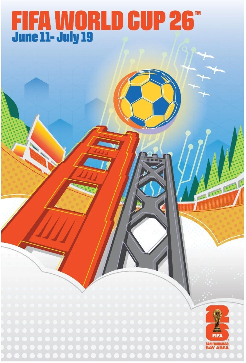
Official San Francisco Bay Area World Cup poster by LeRoy David. Source
The Bay Area hosts the first suburban stadium in our series and, as we will see going forward, geography as destiny. The area beats out its suburban counterparts because it supports multiple transit routes and stations near the stadium and the surrounding area, once you reach it, is relatively walkable. But the “one seat ride” that transit users in Seattle, Atlanta, Houston, and Philadelphia might enjoy is less likely here. Instead, fans will experience a trip chain.
Stadium
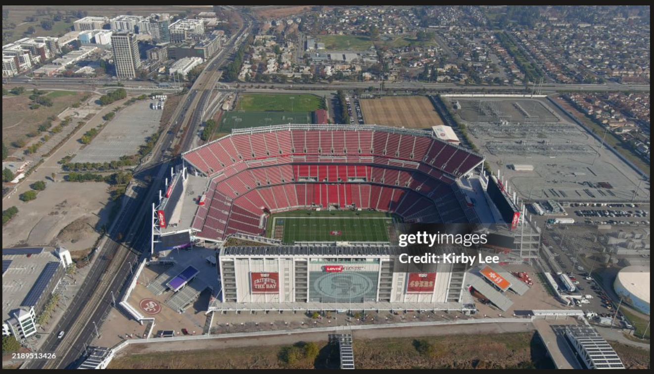
Levi stadium. Image from bing
Before they decamped for the suburbs, the San Francisco 49ers played in Candlestick Park, located on a rocky, industrially zoned point on the western shore of San Francisco Bay. The stadium sat in the Bayview-Hunters Point neighborhood of southeastern San Francisco, one of the city's historically Black communities, adjacent to a decommissioned naval shipyard and ringed by public housing. Despite its physical isolation from downtown, it was embedded in the urban fabric of a dense city: reachable by Muni bus, surrounded by residential neighborhoods, and close enough to the bay that notorious wind and fog became part of its identity. By the 1990s both team and city knew the aging facility needed to be replaced.
The team’s departure to Santa Clara was the product of a decade of negotiations that failed not because the 49ers refused to stay in San Francisco, but because the city couldn't offer them a viable site. A 1997 voter-approved Candlestick Point stadium-and-mall plan went nowhere. By 2006, the team had developed an ambitious replacement proposal: a new stadium embedded in an entirely new mixed-use neighborhood on the Candlestick Point site, designed by Lennar Corporation, with housing, retail, a transit station, parks, and explicitly promised benefits for the long-neglected Bayview-Hunters Point community. Mayor Gavin Newsom rejected it, insisting instead that the team build at the Hunters Point Naval Shipyard (a contaminated Superfund site) in a take-it-or-leave-it posture that critics said reflected a lack of serious engagement. The team also looked at a site in Brisbane, just south of the city, before settling on Santa Clara in 2007. Levi's Stadium was designed for Candlestick Point's cool, foggy microclimate, and when the team transplanted the plans to Silicon Valley without modification, they created a stadium that notoriously bakes in the summer heat — a building literally shaped by a city it was never allowed to be in.
Transit
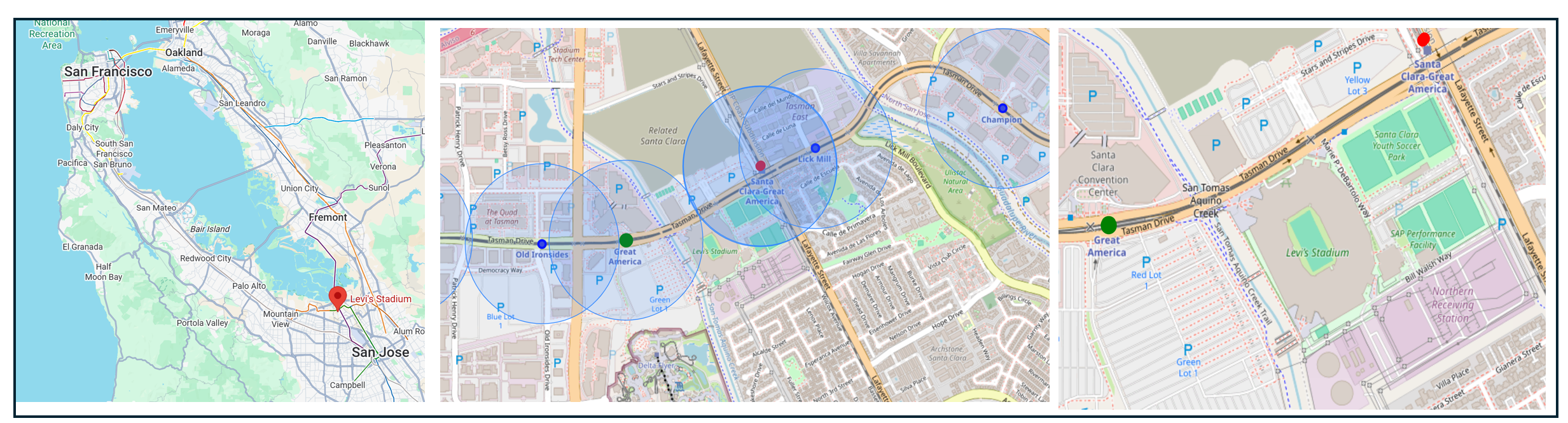
From left: Stadium location regional overview, stadium location with nearby transit stations (the blue circles = a ½ mile radius around the station) and stadium closeup with surrounding streets.
The Bay Area has two of the nation's most significant transit systems — BART and Caltrain — and neither runs to Levi's Stadium. BART, which opened in 1972 as one of the first new heavy rail systems built in America since the Depression, reaches most of the Bay Area but stops well short of Santa Clara County; its southern terminus in Fremont means that South Bay riders still require a transfer. VTA light rail — the system that actually serves Levi's Stadium — was built in the 1980s and 1990s as Santa Clara County's answer to the transit question, but it was designed with a political logic (serving as many jurisdictions as possible) rather than an operational one, and its low-capacity trains and modest ridership have long reflected the mismatch. The deeper structural problem is that the 49ers' move from Candlestick Park to Santa Clara in 2014 took the team from a dense, Muni-served city into the jurisdiction of the weakest major transit system in the Bay Area — a consequence of the failed San Francisco negotiations that no amount of World Cup enhancement can fully resolve.
Urban Fabric and Vitality
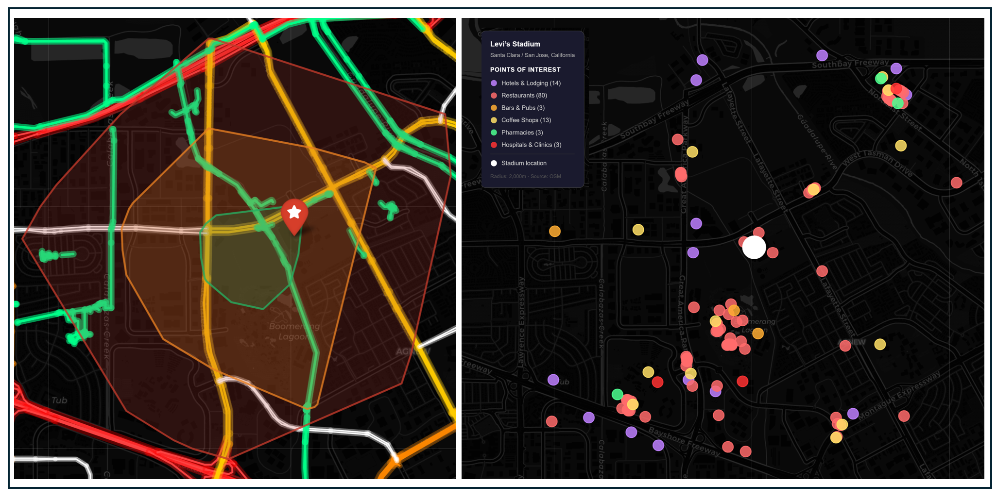
Left: Isochrone map showing a 10-, 20-, and 30-minute walk from the stadium. Highways shaded bright red, arterial roads shaded yellow and bike trails shaded green. Right: Hotels and game-day amenities within 30 minutes of the stadium.
Although most fans will be traveling by transit or car, it is possible to stay nearby the stadium and travel to games on foot. Isochrone mapping shows a 30-minute walk from around the station, although some of the area’s major arterial roads may not be pleasant for foot traffic. Levi's Stadium is also immediately east of the San Tomas Aquino Trail, a paved multi-use path connecting to a continuous 100-mile network including the regional San Francisco Bay Trail. However, the one-mile section of the trail between Agnew Road and Tasman Drive has remained closed to the public before and during stadium events since they began in August 2014. The surrounding area offers plenty of places for fans to eat and drink before the game—if they are staying in of the nearby hotels. (It’s hard to imagine a spectator with an hour train trip will build in extra time before or after the match for a meal nearby).
Parking and Demand Management
There are a total of 31,600 parking lot spaces available for every home game at Levi's Stadium, either on premises or nearby. No specific parking restrictions or maximum spaces have been announced. Official stadium lots range from $50 to $120 prepaid. As for incentives to take transit, VTA offers a joint Caltrain + VTA Day Pass for fans traveling from San Francisco, covering both the Caltrain leg and all-day VTA use, simplifying the fare payment for what would otherwise require two separate ticketing systems.
Projected Attendance
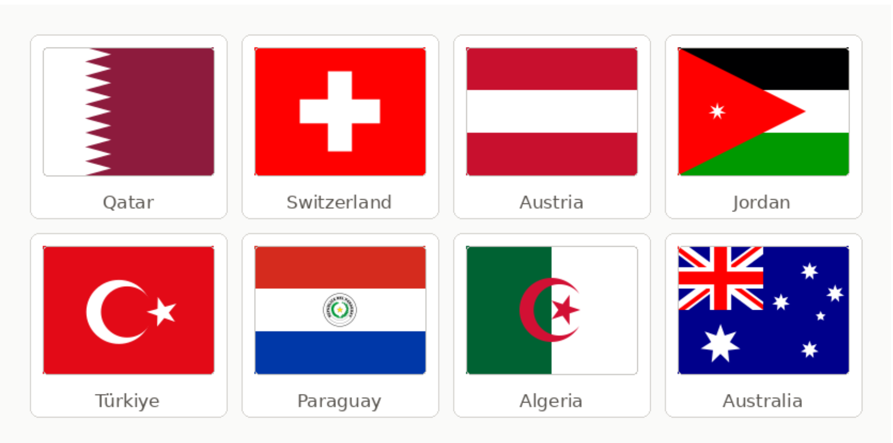
Levi's Stadium hosts six matches across the preliminary rounds plus a Round of 32. The confirmed nations — Qatar, Switzerland, Austria, Jordan, Turkey, Paraguay, Algeria, Australia — are not the marquee draws that Brazil, France, England, or Germany represent at other venues. Four of the six matches fall on weekdays. Stadium capacity for the World Cup is approximately 69,000–71,000. Cumulative attendance approaches 415,000 fans across six matches.
Downstream Effects
Transportation Investments
VTA is planning on running 22 additional trains on game days to decrease wait times and crowding. Caltrain says trains will run every half hour. Additionally, a second and final Green Line train will depart Milpitas after the final VTA train connects riders to BART (this may be as late as 1:40am) on late-night matches. BART and VTA will be matching 20-minute frequencies so the trains line up for a timed transfer. Muni, the transit system in San Francisco, will be providing supplemental service after normal transit operating hours to ensure reliable transportation options for the late night matches
Game Day Crowding and Safety
Multiple transit stations and lines close to the station should mitigate transit chokepoints. However, the VTA Great America Station has had crowding issues in the past. At Super Bowl 50, long queues and crush conditions at the station were widely reported, and VTA has invested in queue management and platform crowd control since. The Mountain View Caltrain station — the key transfer point — may experience significant crowding as thousands of fans converge for post-match connections to San Francisco. (Fans are advised to get into queue lines on the Gate A side of the stadium immediately following the match and to reach their return stop location promptly to connect with Caltrain service).
Fan Travel Time and Cost
Travel time will vary depending on where fans start their day, but this analysis assumes the vast majority of international visitors to the "San Francisco" World Cup will stay in San Francisco, not in San Jose or Santa Clara. For downtown San Francisco-based visitors, the Caltrain-to-VTA trip chain will take approximately 75-90 minutes. Visitors starting in Oakland and taking BART/shuttle option may have a 20-to-30-minute trip. Travel times from Silicon Valley destinations are shorter: 20 minutes from San Jose to the stadium via VTA. Fans taking Caltrain from San Francisco to Mountain View will pay around $6.75.
Impact on Regular Transit Riders
VTA light rail runs daily to the Great America Station. Enhanced service on World Cup match days adds trains and extends operating hours, generally benefiting regular riders on the corridor. The broader VTA network carries modest daily ridership relative to its size — the agency has faced persistent funding challenges and service levels are lower than peer systems. The World Cup's enhanced service is a genuine ridership boost for a system that needs it, even if the incremental benefit to everyday VTA riders is modest.
Cost to Public Agencies and the Taxpayer
VTA General Manager and CEO Carolyn Gonot asked the Bay Area Congressional Delegation for their assistance in obtaining $44 million for "urgent and currently unfunded safety, security and operational needs" associated with the World Cup. FTA is providing $8.8 million to cover eligible activities.
Carbon Footprint
Medium. No restrictions on the stadium’s 31,000 parking spots provide incentives for driving, especially for travelers from downtown San Francisco or Oakland with a long trip. The shuttle bus trips from the Milpitas BART station to the stadium adds to tailpipe emissions.
#6: New York/New Jersey
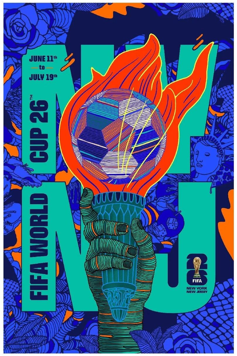
Official New York New Jersey World Cup poster by Rich Tu. Source
It’s hard not to be a bit indignant about what is going on in New York/New Jersey. FIFA chose the region to host the World Cup championship game in an auto-oriented sports arena. They then demanded that New Jersey Transit (NJT) construct a new transit center and busway from scratch to improve connections to the stadium. When NJT attempted to pass along the cost of World Cup service to World Cup fans, FIFA objected and local officials relented, drastically cutting transit fares and left holding a $42 million bag. Honestly, FIFA is walking New Jersey like a dog.
Stadium
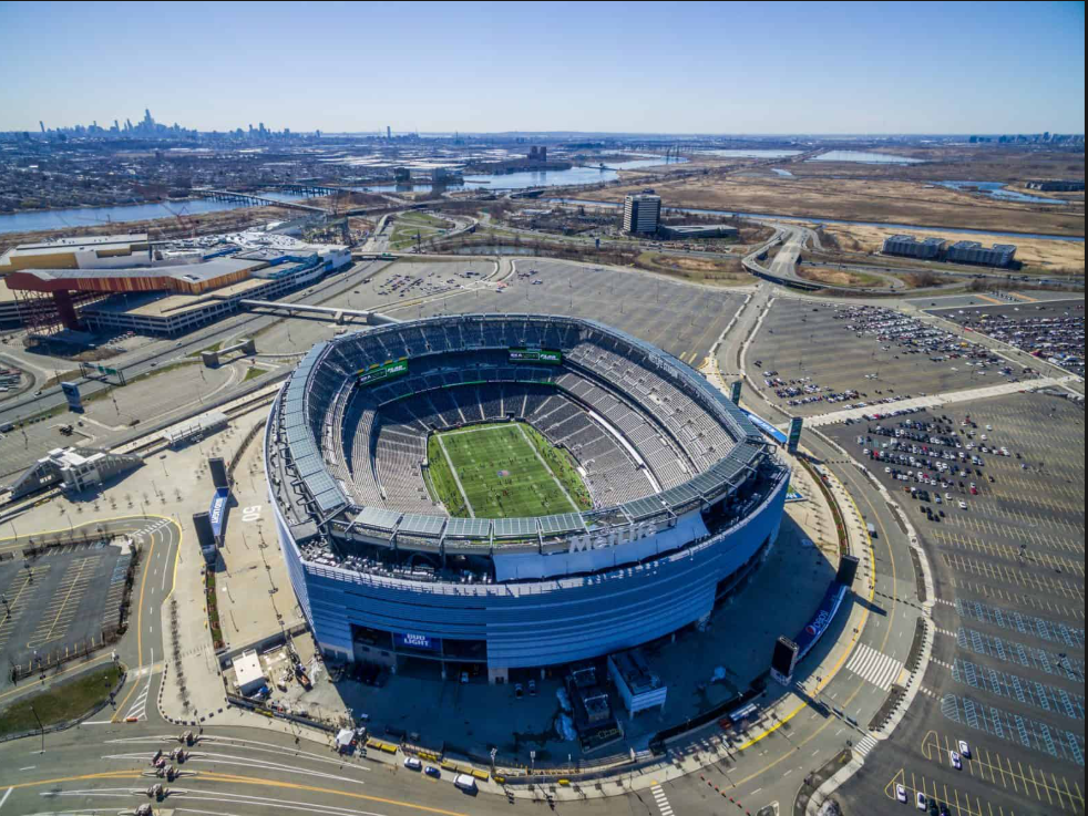
MetLife Stadium. Image from bing
MetLife Stadium sits in the Hackensack Meadowlands of East Rutherford, New Jersey, approximately ten miles west of Manhattan, on a site that tells one of the more revealing stories about mid-century American land use and the politics of sports infrastructure. The stadium's location was set by two distinct pieces of New Jersey legislation. The first, the Hackensack Meadowlands Development Act of 1968, enacted under Governor Richard Hughes, created the Hackensack Meadowlands Development Commission and reflected an ambitious vision: the Hughes administration predicted that the Turnpike-Route 3 interchange would become the center of a major new city on reclaimed wetlands, with housing, industry, commercial centers, and recreation facilities rivaling Manhattan. The second, the New Jersey Sports and Exposition Authority Act — pushed through by Hughes's successor Governor William Cahill and enacted in 1971 — had a more focused mandate: build a major sports center specifically at the intersection of the New Jersey Turnpike and Route 3 and use it to lure a professional sports franchise across the Hudson. The geographic specification was not incidental. Prior to the Meadowlands Commission's establishment, the region was popularly viewed as a dumping ground, and the Hackensack River and its marshes were often seen as places to fill for commercial and industrial development. In 1969, there were nearly 1,900 acres of unregulated landfills in the region, with 51 individual solid waste dumping locations and more than 5,000 tons of waste brought in daily from 118 New Jersey municipalities. The Meadowlands was a landscape so systematically degraded that placing a stadium there provoked no meaningful opposition. The four things the New Jersey legislature found irresistible about the site — cheap land, no displaced residents, existing highway access, and no political resistance — were all downstream consequences of that prior ecological sacrifice.
The teams that arrived at the meadowlands left genuinely urban venues. The New York Giants had played at the Polo Grounds in upper Manhattan from 1925 to 1955, and at Yankee Stadium in the Bronx from 1956 to 1974 — stadiums embedded in the city's neighborhoods and served by its transit system. The move to New Jersey was considered unthinkable: New York City Mayor John Lindsay immediately called the Giants "callous, selfish and ungrateful" and directed the city's corporate counsel to restrict the team's rights. Giants president Wellington Mara framed the move as giving the club "the first real home it has ever had after 46 years in New York, and more convenient and pleasurable surroundings to the tens of thousands of fans who have endured watching football in an aging stadium that was never meant for that sport." Governor Cahill's appointee as first chairman of the NJSEA was David "Sonny" Werblin, former president of the New York Jets — who followed the Giants to the Meadowlands in 1984, departing Shea Stadium in Queens. Two teams that call themselves New York franchises have played in New Jersey ever since. The infrastructure investment that made all of this possible was entirely automotive: the New Jersey Turnpike built Exit 16W as a new western spur connecting directly to the sports complex; Routes 3 and 120 were improved at public expense specifically to serve it. Giants Stadium opened in 1976, built by the NJSEA on land it had assembled from the degraded wetlands. It was replaced by MetLife Stadium in 2010 at a cost of $1.6 billion entirely privately financed by the Giants and Jets ownership groups. The teams simply built on the same footprint.
Transit
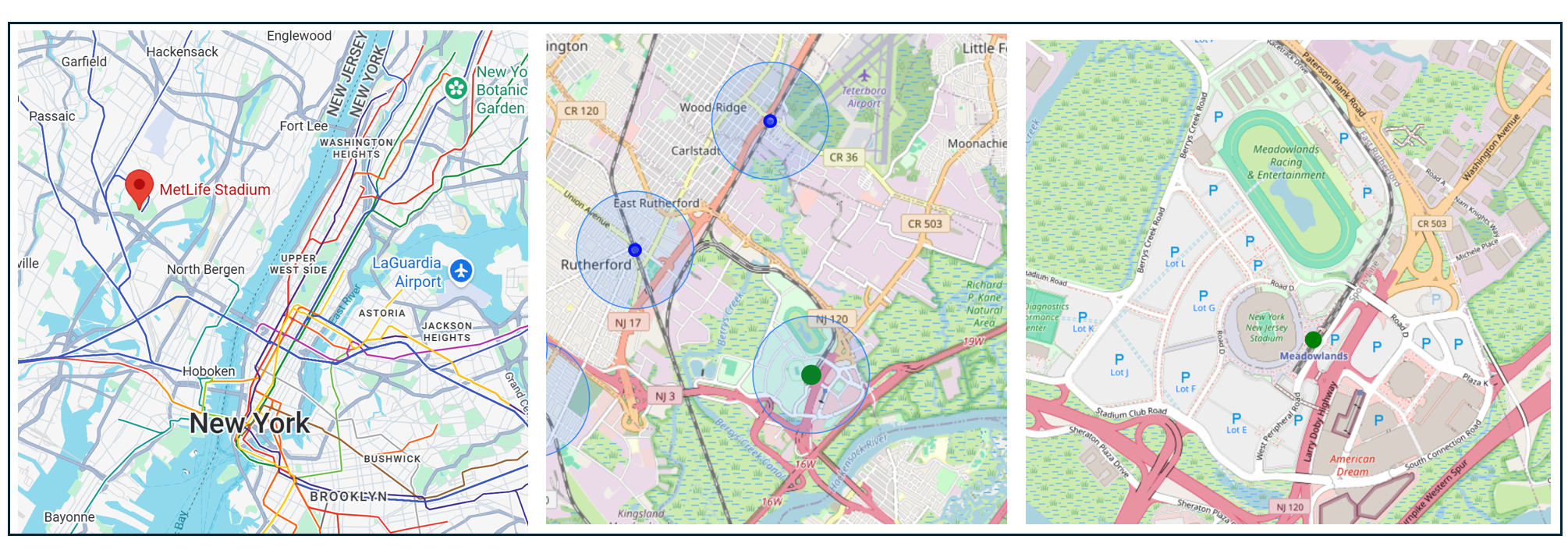
From left: Stadium location regional overview, stadium location with nearby transit stations (the blue circles = a ½ mile radius around the station) and stadium closeup with surrounding streets.
The Meadowlands Rail Line is an NJ Transit shuttle that opened in 2009 as the terminus of a dedicated branch connecting MetLife Stadium directly to Secaucus Junction, about 10 minutes away. From Secaucus, the entire NJ Transit rail network — nine lines, including the Northeast Corridor — converges, giving fans access from virtually any point in New Jersey and from Penn Station in Manhattan. (NJ Transit itself was created in 1979 to absorb the failing private commuter railroads of the region, and its network was built around serving Manhattan-bound commuters, not stadium-bound crowds).
The Meadowlands station is steps from the stadium and the line was purpose-built for this complex. However, despite the adjacent American Dream Mall opening in 2019, the station still does not operate daily service. NJ Transit says daily service may begin "once the rail system is resilient enough that doing so won't adversely affect NJ Transit commuters."
The Meadowlands Rail Line's existing trains can move roughly 10,000 passengers per hour from Secaucus to the stadium. For a venue seating 82,500 hosting the World Cup Final, that is a significant capacity ceiling — which is why the World Cup required new infrastructure to overcome it.
Urban Fabric and Vitality
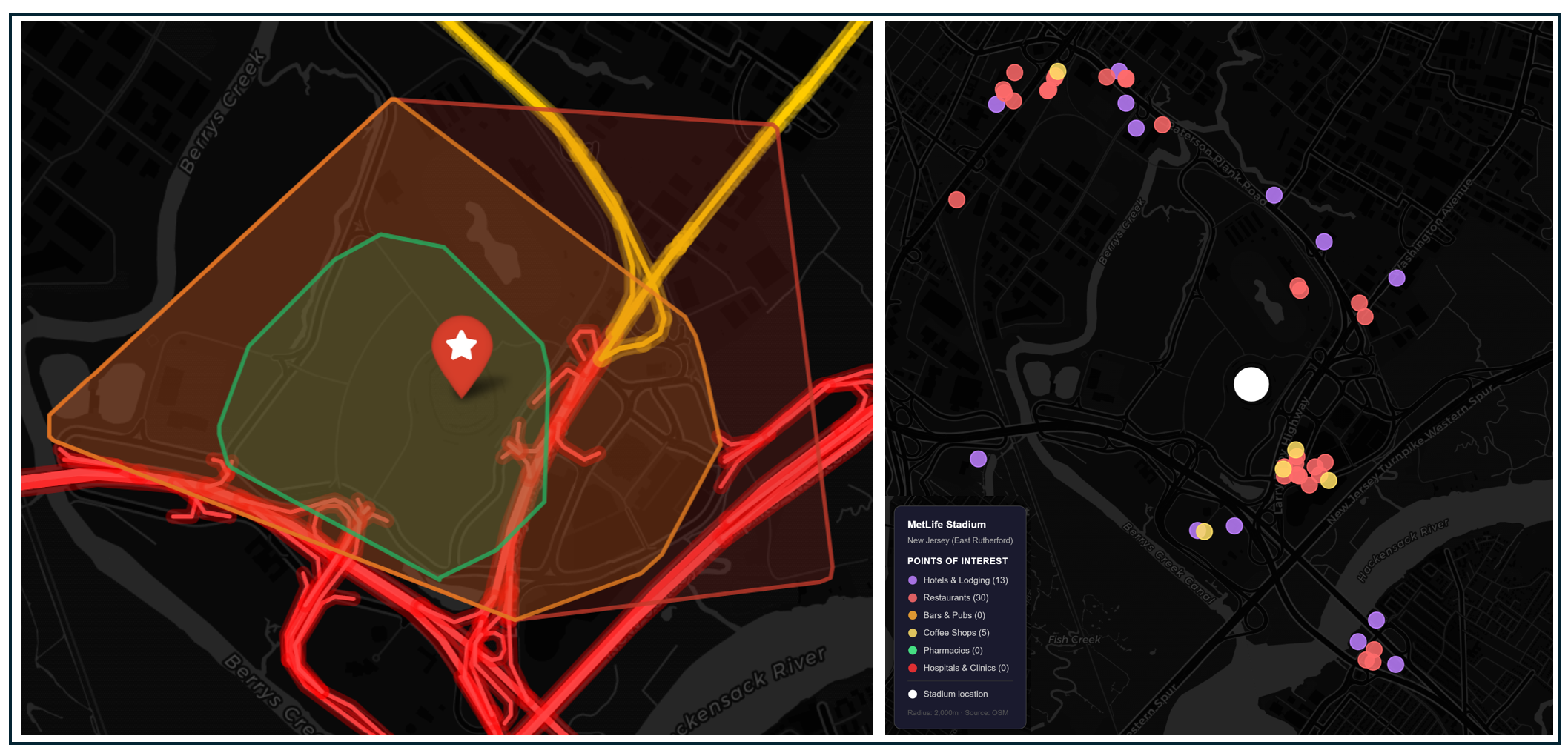
Left: Isochrone map showing a 10-, 20-, and 30-minute walk from the stadium. Highways shaded bright red, arterial roads shaded yellow and bike trails shaded green. Right: Hotels and game-day amenities within 30 minutes of the stadium.
Both the Meadowlands and Lincoln Financial Field in Philadelphia are surrounded by hostile infrastructure, but while Philadelphia spectators can still travel safely on foot to the stadium via Broad Street, no one should walk to MetLife stadium.
The complex is bounded on all sides by highways: the NJ Turnpike, Route 3, Route 17, and the Hackensack River. Even though the complex is a short walk as the crow flies from one of the most densely populated areas in the United States, the highway-scale access roads that define the Meadowlands make pedestrian arrival functionally impossible from any origin beyond the immediate complex.
There are a handful of hotels in the Meadowlands complex and two pedestrian bridges connect the American Dream Mall directly to MetLife Stadium, but on site capacity is insufficient to serve the vast majority of attendees.
Parking and Demand Management
World cup organizers have announced there will be no general spectator parking on stadium property on any match day. The lots are being used for a fan village, shuttle bus operations, and FIFA staff areas. The only vehicle parking option is a limited supply of prepaid spots at the American Dream Mall, currently priced at $225 per match.
Projected Attendance
MetLife hosts 8 matches — the most of any single venue in the tournament — including the tournament's highest-stakes fixtures. NJ Transit expects to transport more than 78,000 spectators for each match at the venue. Stadium capacity for the World Cup is approximately 82,000 (seats were modified to widen the field). Cumulative attendance across 8 matches approaches 656,000 fans — the highest absolute demand of any venue in our study
Downstream Effects
Transit Investments
The Meadowlands Rail Line provides direct rail access, but its capacity of 10,000 passengers per hour is inadequate for 82,000 fans, and the World Cup required NJ Transit to build an entirely new bus infrastructure layer to make the numbers work.
A new bus terminal was constructed at the stadium, and a "TransitWay" — a partially dedicated bus-only lane — was built to double transit capacity between Secaucus and MetLife using large articulated buses. NJ Transit's board approved a contract worth up to $3.4 million with Yankee Line to assist with bus operations during the tournament. The New Jersey Turnpike Authority approved $4 million for a fleet of 85 contingency buses in case of rail disruptions.
The combined rail-and-bus system is designed to move 40,000 passengers per match using transit, with roughly an additional 15,000–20,000 via buses and official shuttles. It is a heroic engineering effort, but it is still a workaround, built on the back of a stadium that the land-use and infrastructure context never anticipated serving without cars.
Game Day Crowding and Safety
Planners can expect a crowd chokepoint is Secaucus Junction, where all NJ Transit lines converge before the Meadowlands shuttle branch. Penn Station, already the busiest train station in the Western Hemisphere, will see an additional 28,000 fans traveling from New York City through to Secaucus before switching to the Meadowlands line. Planners have implemented World Cup-specific ticketing, boarding groups, and security checkpoints for four hours before each match. The post-match exodus — 82,000 people converging on a few transit options simultaneously — will be the single most demanding crowd management operation of the entire US World Cup
Fan Travel Time and Cost
It will take fans approximately 30–45 minutes to travel from Penn Station to the stadium, including the Secaucus transfer. From New Jersey origins, fans routing through Secaucus or Hoboken and face similar journey times. The bus shuttle from Port Authority Bus Terminal takes roughly 20–30 minutes in dedicated traffic.
The transit pricing situation at MetLife has been the most publicly contested transportation story of the US World Cup preparation to date. NJ Transit initially announced $150 round-trip train tickets (nearly 12 times the standard $12.90 fare) justified on the grounds that it was charging fans the "at cost" price to provide event service, including extra security and labor. NJ Transit President Kris Kolluri estimated the total cost to NJ Transit at $62 million, with the federal government contributing $10.6 million and the host committee providing just over $3 million, leaving NJ Transit responsible for a $48 million shortfall — with nothing from FIFA.
After sustained public backlash, intervention by both governors, and pressure from FIFA, NJ Transit reduced the fare from $150 to $105, then to $98. Simultaneously, New York Governor Hochul announced the shuttle bus price would drop from $80 to $20, funded by $6 million from New York State and private sources.
Impact on Regular Transit Riders
Beginning four hours before each match, there will be no outbound NJ Transit rail service from Penn Station available for commuter travel. Regular commuters not attending the match are redirected to PATH train service from 33rd Street and NJ Transit bus service from Port Authority Bus Terminal. These may be functionally adequate alternatives but carry a significant disruption to the hundreds of thousands of people who depend on NJ Transit out of Penn Station daily. Port Authority Executive Director Kathryn Garcia summed it up this way: "If you are not attending one of the events, please work from home because the city will be incredibly congested and so will New Jersey."
Cost to Public Agencies and the Taxpayer
NJ Transit estimates the total cost of World Cup service at $62 million, with $10.6 million from the FTA, just over $3 million from the NYNJ host committee, and a remaining $48 million shortfall that NJ Transit itself must cover — and no support from FIFA. New York State's $6 million shuttle bus subsidy adds to the regional public investment. The New Jersey Turnpike Authority committed $4 million for contingency buses. Adding infrastructure: the new bus terminal and TransitWay represent additional capital spending not fully disaggregated in public reporting. NJ Transit President Kolluri stated explicitly: "Commuters in New Jersey should not carry the cost years into the future for this wonderful event, but the fans going to the game should bear the burden of the cost."
Carbon Footprint
Low. The stadium parking restrictions significantly curtail the amount of tailpipe emissions that would come from driving to the game. That said, the extensive shuttle service required to meet game day demand adds emissions that would not otherwise occur if the host city were able to rely on New Jersey Transit trains.
#7: New England
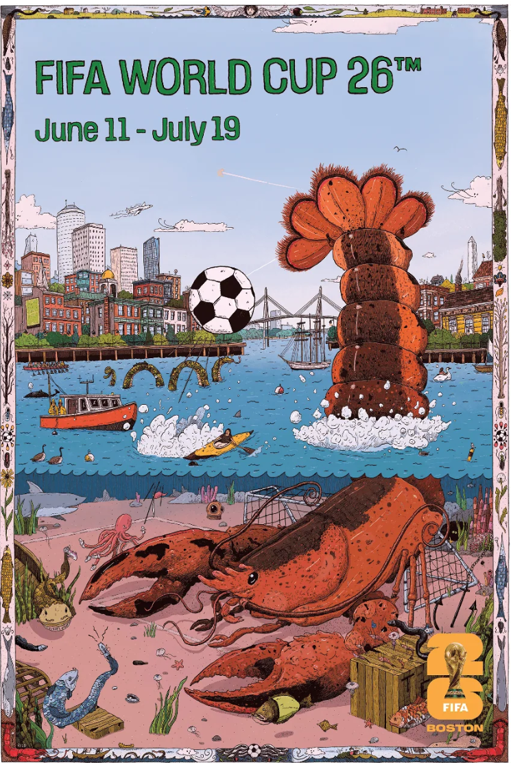
Official Boston World Cup poster by John Rego. Source
New England's seventh-place ranking reflects a structural reality of an exurban stadium location not particularly well served by public transportation. The $35 million in transit infrastructure upgrades being made for the World Cup represent, in all likelihood, the largest single investment this corridor has ever received, and these expenses were made to satisfy the demands of an international soccer tournament rather than any public judgment about what the region deserves. Travelers coming from around New England may have time to grow a beard before they enter the stadium named after shaving cream manufacturer, Gillette. Is the best a fan can get?
Stadium
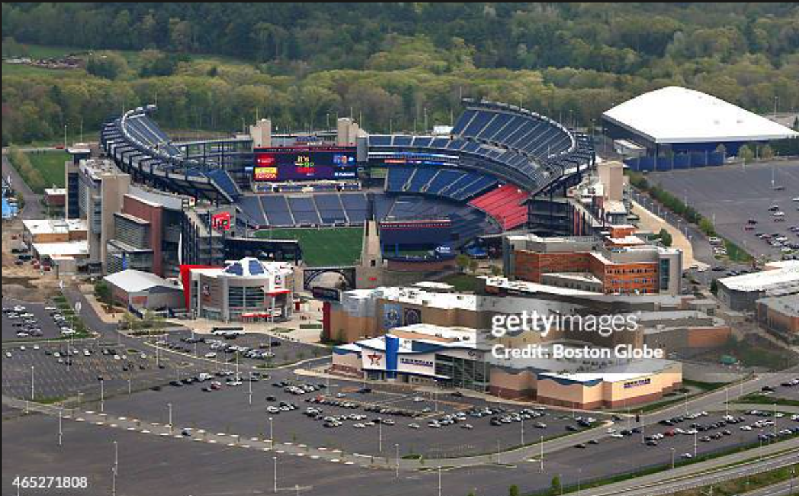
Gillette Stadium. image from bing
Gillette Stadium opened in 2002 in Foxboro Massachusetts, replacing the adjacent Foxboro Stadium that had stood on the same site since 1971 — but the Foxboro location itself traces back to an act of civic desperation. The Boston Patriots had spent their first decade as nomads, cycling through Fenway Park, Alumni Stadium at Boston College, and Harvard Stadium without a permanent home. The team’s wandering ended when E.M. Loew, the owner of Bay State Raceway, donated the land to Patriots owner Billy Sullivan specifically to keep the team in New England. The stadium cost just $7.1 million and received no public funding, and Foxboro’s midpoint position between Boston and Providence gave the franchise a plausible claim on the entire New England fan base.
When Robert Kraft began pursuing a replacement stadium in the mid-1990s, he made several serious attempts to come to the city. A South Boston proposal — part of a broader "Boston Sports Megaplex" concept — collapsed after the plan leaked and neighborhood opposition hardened. Providence was explored and abandoned. The most dramatic near-miss came in 1998: after failing to secure a stadium deal in South Boston and being blocked by the Massachusetts House on infrastructure funding, Kraft turned to Connecticut, where Governor John Rowland had reimagined Hartford's Adriaen's Landing riverfront redevelopment around a new Patriots stadium on the banks of the Connecticut River. Connecticut offered a $374 million taxpayer-funded downtown stadium and the state legislature overwhelmingly approved it. Kraft stood next to Rowland at a press conference announcing the move — then walked away when Massachusetts finally relented with infrastructure aid and tax credits. He later reflected that he had turned down what amounted to $1.2 billion in present value with no personal financial risk. The result was Gillette Stadium: $325 million, entirely privately funded by the Kraft Group, built on land Kraft already owned, in a town of 18,000 people surrounded by highway exits and pine trees. The choice to stay in Foxborough was ultimately driven by land ownership, private financing logic, and the political leverage that a credible, signed Hartford agreement finally gave Kraft over a reluctant Massachusetts legislature, not by any vision of what a stadium could be for a city.
Transit
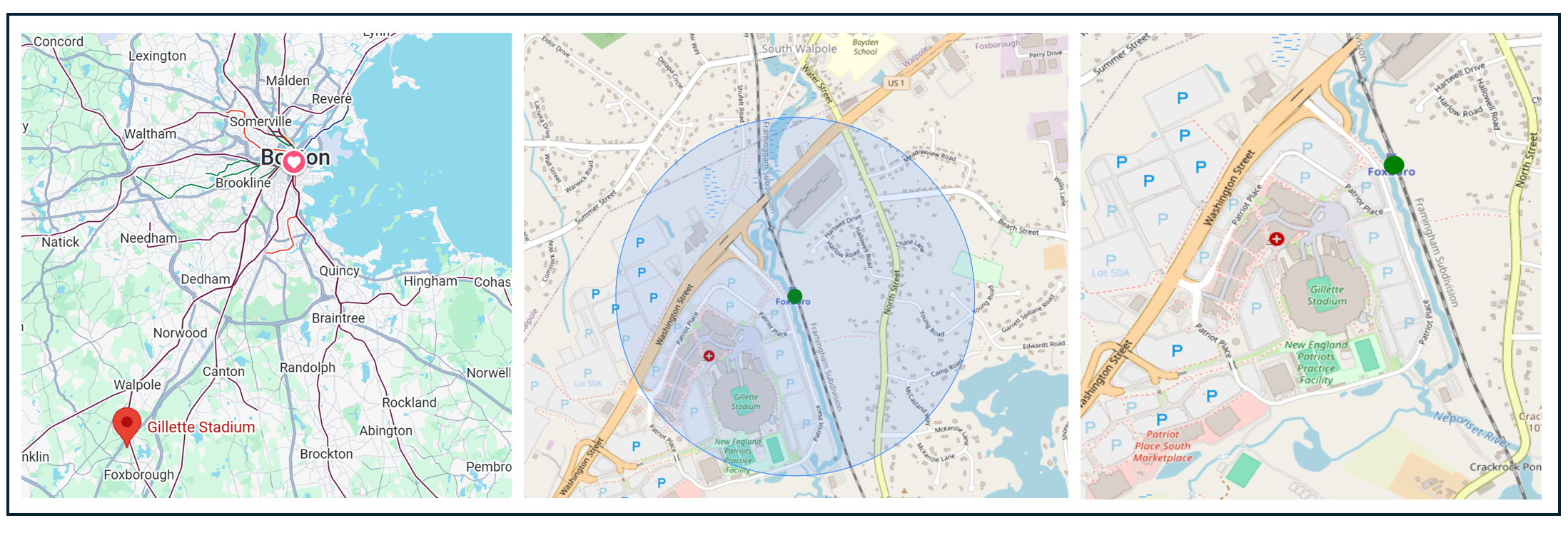
From left: Stadium location regional overview, stadium location with nearby transit station (the blue circles = a ½ mile radius around the station) and stadium closeup with surrounding streets.
The MBTA has the distinction of operating North America's oldest subway — the Tremont Street Subway opened in 1897 — and the disadvantage of serving a region that placed its NFL stadium 30 miles outside its coverage area. The Foxboro commuter rail station exists solely for events: it opened in 1986 for Patriots games and until recently had no meaningful weekday service. The Franklin/Foxboro Line branch was historically a freight corridor; its passenger service was added as a stadium convenience rather than as a community transit investment. The MBTA's broader challenges — decades of deferred maintenance, a Green Line Extension that took years longer than planned, chronic underfunding — have made system expansion politically difficult even in areas with genuine transit demand.
The Foxboro station has a single side platform serving the main track of the Framingham Secondary. A pedestrian walkway from the station runs under an access road to the north end of the stadium.
Two structural constraints define what this rail service can and cannot do. First, the station's single track creates a fundamental bottleneck that limits how many trains can serve the station at once. Second, the branch sees essentially no other passenger service.
Urban Fabric and Vitality
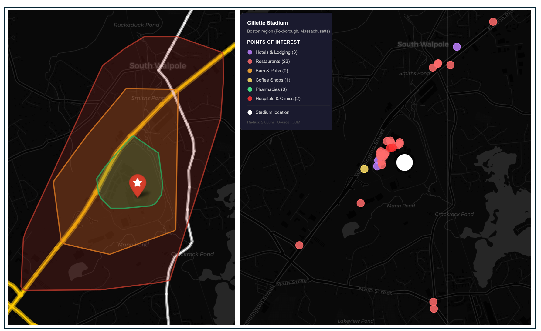
Left: Isochrone map showing a 10-, 20-, and 30-minute walk from the stadium. Highways shaded bright red, arterial roads shaded yellow and bike trails shaded green. Right: Hotels and game-day amenities within 30 minutes of the stadium.
The stadium area landscape around Gillette Stadium is similar to that of the Meadowlands-sparsely populated and unwalkable, aside from the pedestrian walkway from Foxboro Station to the north end of the stadium. Officials explicitly cautioned visitors against walking or biking along Route 1 to reach the stadium. Beyond that quarter mile, the surrounding landscape is hostile to anyone not in a vehicle.
Patriot Place, directly adjacent to the stadium, provides a few walkable destinations and two hotels, For the broader urban exploration that World Cup visitors typically expect — the kind that generates hotel stays, restaurant visits, and cultural experiences — Foxborough offers almost nothing beyond this single corporate campus.
Parking and Demand Management
Organizers announced that parking at Gillette is being restricted, dropping from 20,000 available for a Patriots home game to approximately 5,000 spaces for pre-sale at $175 apiece, (though FIFA has announced there is the potential to add thousands more). Independent satellite lots along Route 1 account for another ~5,000 spaces. The total parking ecosystem, including satellite lots, may reach 10,000 vehicles per match day.
Projected Attendance
Boston Stadium hosts seven matches with a stadium capacity of approximately 63,815 fans. The confirmed nations — Haiti, Scotland, Morocco, Iraq, Norway, England, Ghana, France — include some of the tournament's largest traveling fan bases: England, France, and Norway will draw significant European visitors. Cumulative attendance across seven matches approaches 447,000 fans.
Downstream Effects
Transportation Investments
This summer, the MBTA will operate 14 express trains on match days between South Station and Boston Stadium, a service level MBTA General Manager Phillip Eng called "monumental."
The project also constructs a permanent accessible high-level platform on the stadium side of the station — 800 feet long, with full-door level boarding — and a temporary 600-foot platform on the neighborhood side. The key word is temporary. The MBTA plans to remove the second platform after the World Cup ends. The operational capability that makes 14 trains per match day possible — loading and unloading two trains simultaneously — disappears with it.
The MBTA explored providing direct rail service between Providence, RI and Foxborough but determined the service was not operationally feasible. Instead, planners have organized the "Boston Stadium Express" bus, run by Yankee Line from more than 20 locations in Massachusetts and Rhode Island. The service is designed to serve up to 10,000 fans per match, with pickup points at every terminal at Logan International Airport and at the Rhode Island Convention Center in Providence
Game Day Crowding and Safety
South Station will see large crowds requiring extra travel time. Boarding Group letters (A through E) are assigned to manage platform queuing, and fans must check in at assigned times before boarding. Even the expanded platform at Foxboro Station may experience chokepoints. The fact that the five matches have weekday afternoon kickoffs compounds the challenge: both South Station and Route 1, the only road in and out, will carry both normal commuter traffic and World Cup crowds simultaneously.
Fan Travel Time and Cost
The MBTA Boston Stadium Train runs express from South Station to Foxboro Station in approximately one hour. For fans staying in Boston itself, the door-to-stadium time is roughly 90 minutes accounting for South Station queuing and check-in procedures
MBTA's "Boston Stadium Train" costs $80 round trip from South Station. This is more than four times the normal event-day round-trip price of approximately $20, and roughly ten times the standard single-ride commuter rail fare. The Boston Stadium Express bus costs $95 round trip.
Fans from Providence who want to take the train to the game must travel 45 miles north to Boston's South Station, then spend $80 to ride 27 miles back south to Foxboro — a round trip of over two hours for a journey that by car takes roughly 40 minutes.
Impact on Regular Transit Riders
Temporary Commuter Rail service changes will be in place for 35 days (June 8 to July 12). The entire southside of the Commuter Rail network will operate on match-day specific schedules for each of the seven match days. Thirty-five days of schedule disruption to a major transit network is a significant imposition on commuters who rely on the Franklin, Providence, and related lines.
The new stadium-side high-level platform will deliver real benefits for everyday riders. The permanent platform enables full-door, all-height level boarding for every single car. Previously, Foxboro Station had only one accessible car per train. Now every door allows level boarding, which speeds up loading and unloading significantly which benefits the current weekday service of roughly a dozen daily round trips. Station upgrades also allow MBTA to provide more service for future events.
Cost to Public Agencies and the Taxpayer
The MBTA is investing more than $35 million in track and infrastructure upgrades on the Framingham Secondary and Foxboro branch to enable the 14-train match-day service. The $80 train ticket revenue helps offset this cost — at 20,000 tickets per match across seven matches, the MBTA could gross up to $11.2 million in ticket revenue, partially but not fully recovering the investment. (It does not appear that the Yankee Bus Service is publicly subsidized).
Some of the MBTA investments may have lasting positive impacts, but the number of people who will benefit from them is small. Foxboro Station only received permanent weekday service in October 2023, after a 2019 pilot was suspended during COVID and a second pilot ran from 2022 onward. By late 2023, daily boardings were running 112–133 passengers per day. Even with the potential for expanded capacity for future stadium events, a $35 million station serving 120 daily weekday commuters, justified primarily by seven match days of event service, is a ratio worth sitting with.
One additional complication: the MBTA violated state bidding laws in its rush to complete the Foxboro station improvements in time for the World Cup, adding the construction to an existing unrelated contract rather than conducting a separate public bidding process, according to the state attorney general's office. The urgency of the World Cup deadline became a reason to bypass the procurement rules that exist to protect public value.
Carbon Footprint
Medium. Some announced parking restrictions will reduce driving and tailpipe emissions. On the other hand, the extensive regional bus network will add more vehicles traveling many more miles than on a typical day in New England.
#8 Los Angeles
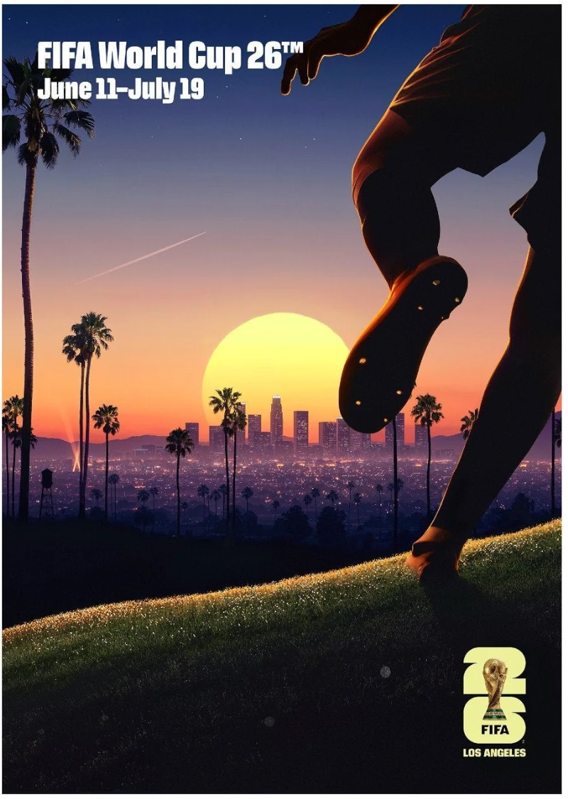
Official Los Angeles World Cup poster by Thieb Delaporte-Richard. Source
So close, and yet so far! Los Angeles is the first host city in our series (though not the last) where fans cannot take rail transit directly to the game. The city came tantalizingly close to joining its peer cities Atlanta and Houston which integrated sports facilities and rail lines in an otherwise auto-oriented context. A federally approved, fully funded automated connector would have closed the last mile to SoFi Stadium in time for the 2028 Olympics. Then Stan Kroenke and Steve Ballmer — the billionaire owners of the two venues the connector would have served — killed it, citing concerns about their property, while contributing exactly nothing toward its construction. The city ranks eighth as a result.
Stadium
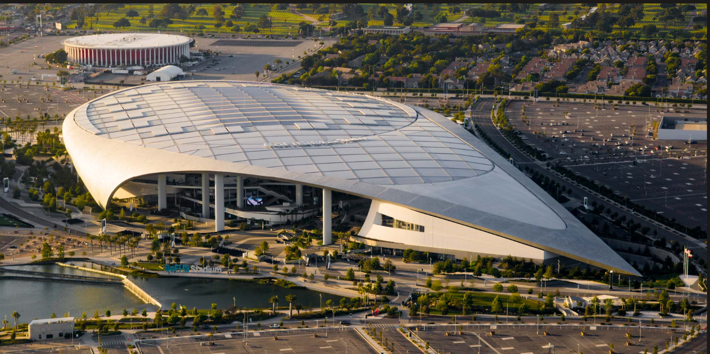
SoFi Stadium. Image from bing
SoFi Stadium occupies the former site of Hollywood Park, a thoroughbred racetrack founded in 1938 by Warner Brothers executives and other Hollywood moguls on 100 acres of flat Inglewood land. The track closed in December 2013, its land deemed more valuable for development than for racing.
In the 2010s, Los Angeles was a city in search of a football franchise. The Los Angeles Rams had played at Memorial Coliseum, an urban, transit-served location roughly 3 miles from downtown LA, before departing for Anaheim and then to St. Louis. The Los Angeles Raiders, who also used to play in LA, had departed for Oakland but were eyeing a return. Sports boosters set out to plan a facility that would win back an NFL team.
The leading contender for a new team’s home was located downtown. AEG's "Farmers Field" proposal, a 72,000-seat stadium adjacent to Staples Center and the Convention Center, in the heart of downtown Los Angeles. was unanimously approved by the LA City Council in 2012, supported by $700 million in naming rights commitments from Farmers Insurance, and backed by extensive planning that included a 10,000-page, $27 million environmental impact report. It also would have had genuine transit access, embedded in a walkable urban district already served by Metro rail. It died in 2015 because no NFL team would commit.
Meanwhile, Rams owner Stan Kroenke had quietly purchased a 60-acre parcel adjacent to Hollywood Park before the formal competition even began, and when NFL owners voted in January 2016, they chose his $1.86 billion privately financed Inglewood plan.
Inglewood is a majority Black and Latino city that, even before construction began, was already exposed to more environmental burdens than 96 percent of California communities — sandwiched between LAX, the second-largest oil field in LA County, and two of the region's busiest freeways. The stadium was approved by the Inglewood City Council just six weeks after plans were unveiled, without an environmental impact report and without public hearings, through a California law loophole that allowed it to be grafted onto a 2009 redevelopment plan. The community was promised jobs, economic development, and transit access; what it has also received is surging rents, school closures, and displacement. Since stadium construction began in 2016, thousands of fans have flocked to the neighborhood on game days. Meanwhile, Inglewood's public school enrollment has dropped from 9,000 to 7,000 students.
Transit
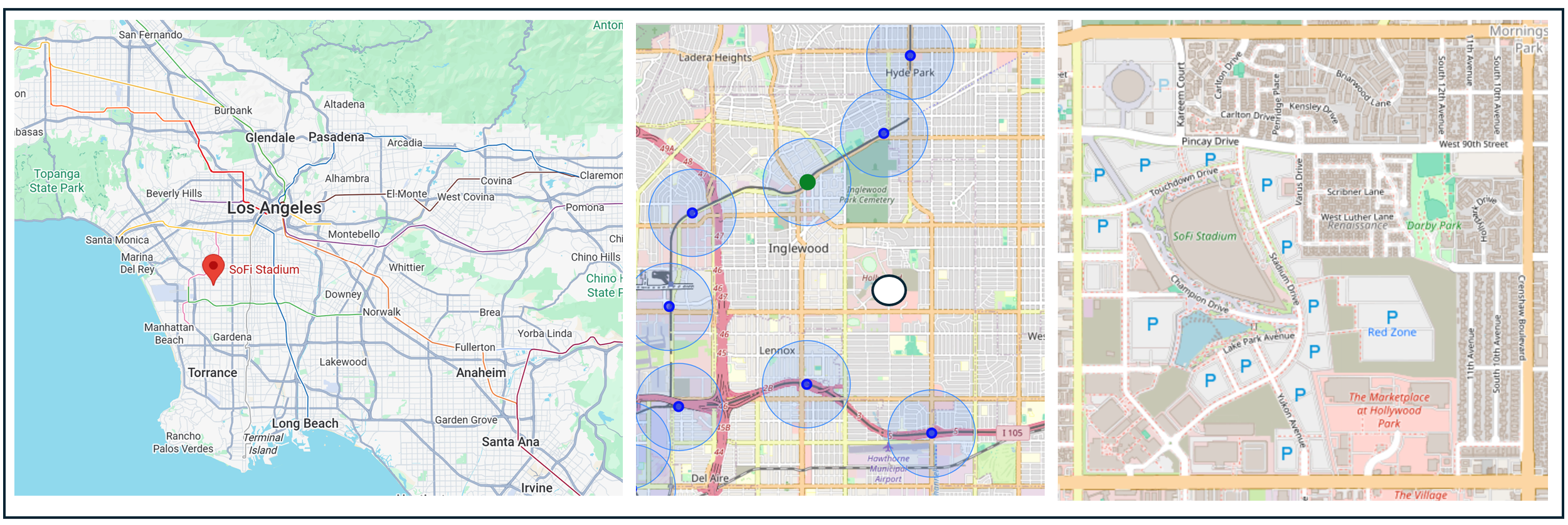
From left: Stadium location regional overview, stadium location with nearby transit stations (the blue circles = a ½ mile radius around the station) and stadium closeup with surrounding streets.
Los Angeles's transit history is haunted by the Pacific Electric "Red Cars," the interurban railway network that once made it one of the best-connected urban regions in the country, systematically dismantled through the 1940s and 1950s. Modern LA Metro rail began with Proposition A in 1980, and the first Blue Line opened in 1990 — decades behind peer cities. The Crenshaw/LAX Line (now the K Line), the most relevant line for SoFi Stadium, opened only in 2022, representing one of the most recent major rail additions in the country. Inglewood itself was for decades among the least transit-served communities in LA County despite being dense, transit-dependent, and surrounded by some of the region's most congested freeways. The K Line's opening was a genuine step toward correcting that inequity, but it left a last-mile gap: the Downtown Inglewood station sits 1.5 miles from SoFi Stadium, still too far to walk for most fans.
The Inglewood Transit Connector was designed to close that gap — a 1.6-mile fully elevated, automated people mover linking the K Line station directly to SoFi Stadium, Intuit Dome, Kia Forum, and the Hollywood Park Casino, planned to open by 2027 in time for the 2028 Olympics. The project had cleared federal environmental review, secured FTA approval for up to $1 billion in Capital Investment Grants, and had the backing of Inglewood's mayor, who framed it as a long-overdue act of transit equity for a community that had been promised connectivity and never received it. It was killed by a coalition that doesn't usually share a stage. Rams owner Stan Kroenke and Clippers owner Steve Ballmer — whose venues would have been directly connected to Metro rail — opposed the connector, claiming it threatened their property and development plans, while contributing nothing toward its construction. Congresswoman Maxine Waters, who had championed the project and secured an early $15 million federal grant for it, reversed course in 2024, citing the project's staggering cost-per-mile and the displacement of forty-plus Inglewood businesses through eminent domain; days after she wrote to the Transportation Secretary urging him not to sign the funding agreement, a Republican-led House appropriations committee stripped $200 million from the project's budget. As costs swelled toward $3 billion with no private contribution from the benefiting venue owners, the funding structure collapsed. The city pivoted to dedicated bus lanes and shuttle infrastructure. The stadium owner who built a transit-forward mixed-use development actively killed the transit connector to his own stadium.
Urban Fabric and Vitality
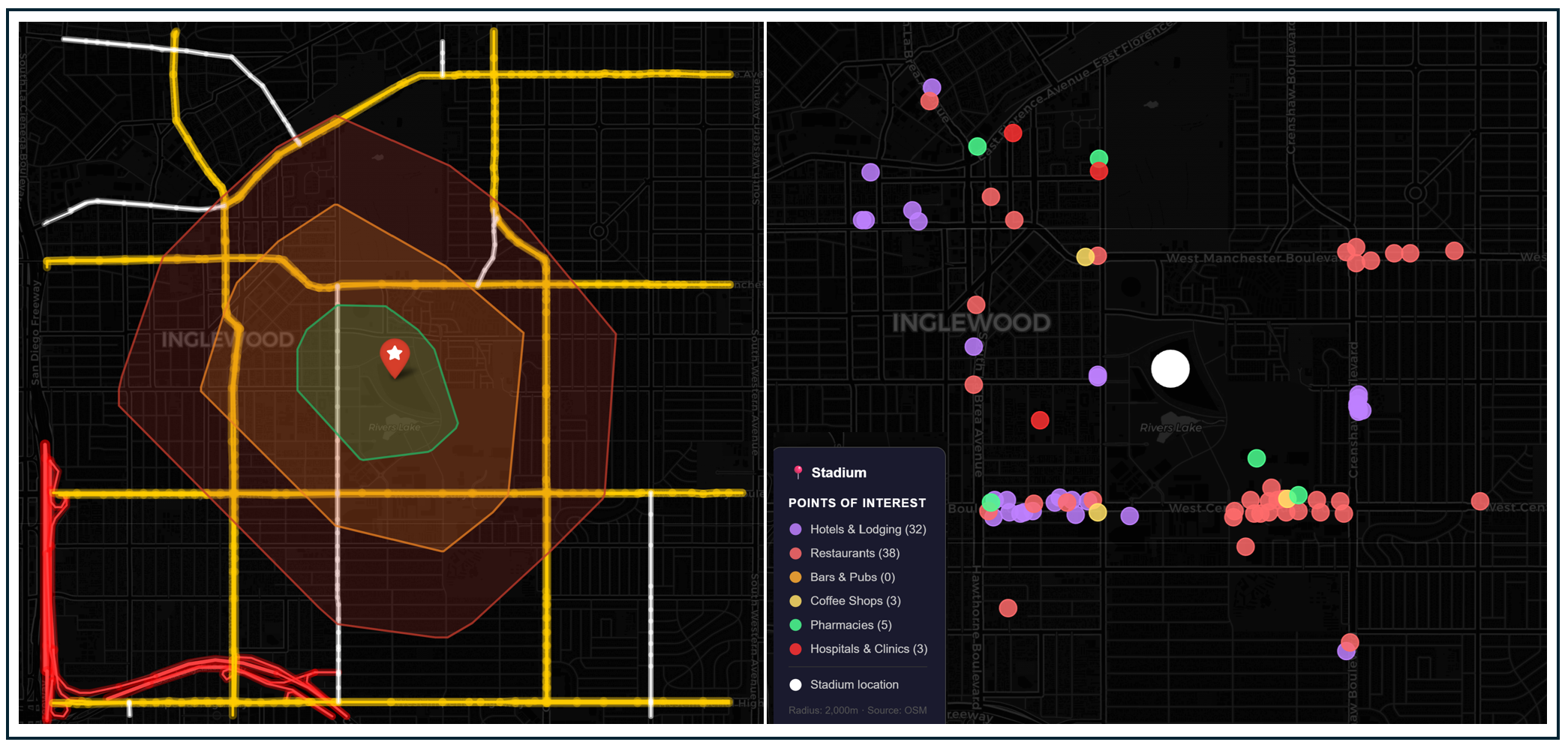
Left: Isochrone map showing a 10-, 20-, and 30-minute walk from the stadium. Highways shaded bright red, arterial roads shaded yellow and bike trails shaded green. Right: Hotels and game-day amenities within 30 minutes of the stadium (although the legend lists 0 bars and pubs, there probably are some nearby and the result is due to OpenStreetMap volunteer mappers undercounting them or classifying them as restaurants).
Even though trains do not run directly to SoFi stadium, pedestrians can get to the arena from all directions within 30 minutes, and there are good options for people staying close by. Hollywood Park is a nearly 300-acre mixed-use development anchored by up to 890,000 square feet of retail, surrounded by creative office space, linked by walkable paseos and plazas.
Parking and Demand Management
About 9,000 parking spaces are spread across structured garages and surface lots in the Hollywood Park complex. This is dramatically fewer than the other car-oriented stadiums we've examined and reflects the mixed-use TOD design intent. The structured garage format also means far less surface parking lot area consuming the campus footprint, leaving room for the parks, retail, and pedestrian plazas that define the fan experience. Official FIFA lot passes are priced between $250 and $300 depending on the match
LA Metro is offering its World Cup Enhanced Service for just $1.75 each way — a flat fare that includes transfers and direct access to World Cup shuttles. Fans who choose park-and-ride have their shuttle ticket included in the parking cost. Amtrak is offering a 20% discount on fares to and from Los Angeles for World Cup travelers
Projected Attendance
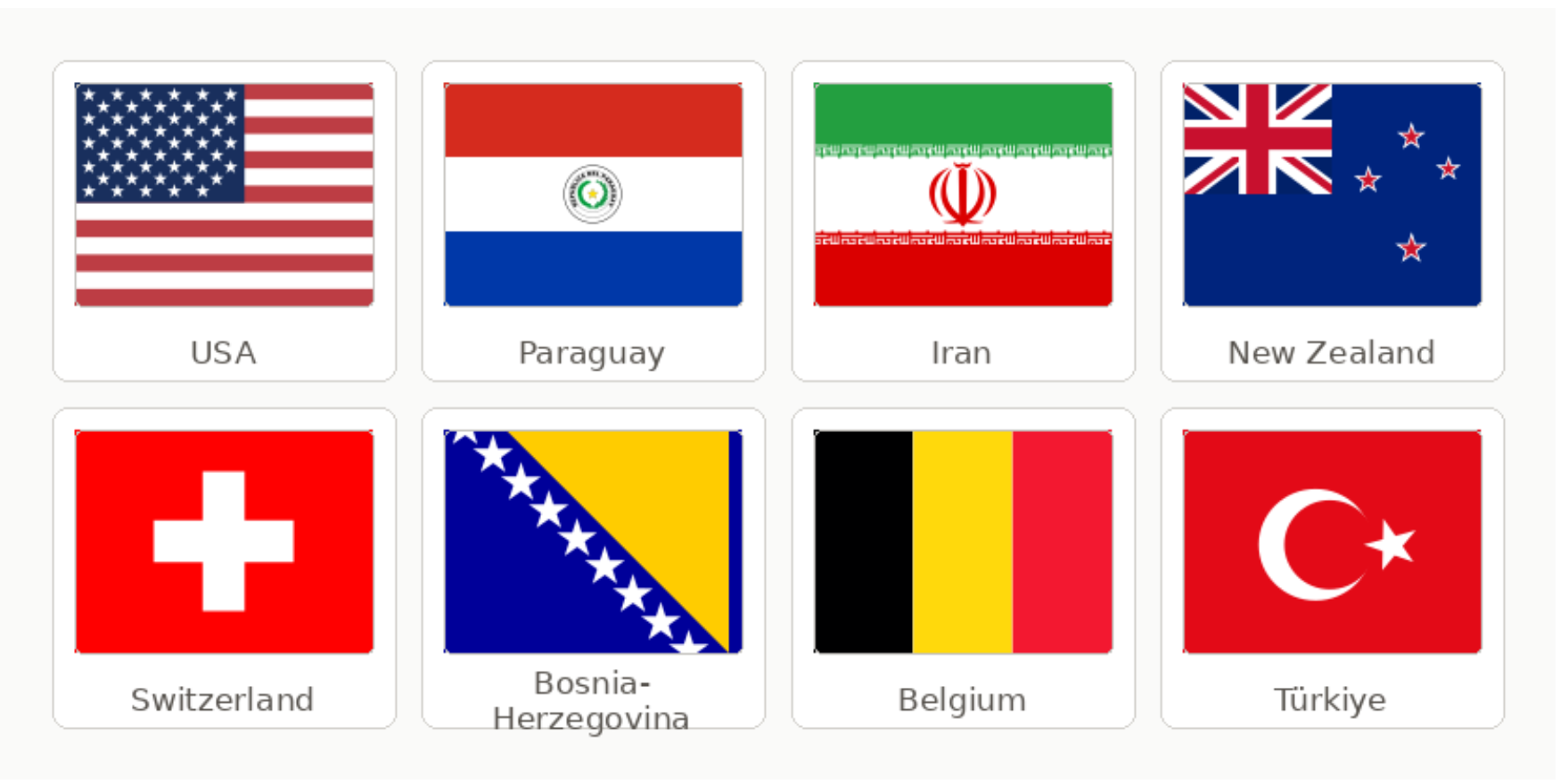
Los Angeles hosts 8 matches at SoFi Stadium: 5 group stage games plus 2 Round of 32 matches on June 28 and July 2, and a Quarterfinal on July 10. SoFi's World Cup capacity is 69,650 in soccer configuration, The United States is among the eight countries scheduled to play in Los Angeles, which should draw significant fan turnout. Total cumulative attendance across 8 matches approaches 557,000 fans.
Downstream Effects
Transit Enhancements
Despite two rail lines in the vicinity, neither line terminates close to the stadium door. To bridge this gap, Metro is providing 300 dedicated shuttles per match from the stadiums closest to the station and from 15 park-and-ride locations across LA County and 2 in Orange County, in order not to disrupt regular service for everyday riders. About 200 of those 300 buses will be borrowed from 11 regional transit agencies, including Foothill Transit, Riverside Transit Agency, Montebello Transit, Big Blue Bus, Culver City Transit, Long Beach Transit, OmniTrans, OCTA, Torrance, Montebello, Norwalk, and Access Services.
The killed Inglewood Transit Connector would have eliminated this last-mile gap entirely. Its absence means that even with significant rail infrastructure nearby, World Cup fans still need a bus bridge.
Game Day Crowding and Safety
World Cup Planners’ distributed network of rail lines and shuttles should help ease overcrowding. The LAX/Metro Transit Center, the Downtown Inglewood K Line station, and the Hawthorne/Lennox C Line station each serve different geographic catchment areas. Fans coming from the Westside and Downtown tend to reach the LAX/Transit Center; fans coming from South LA and the 105 corridors tend to use Hawthorne/Lennox; fans coming from LAX itself or traveling by Metrolink tend to converge on the Transit Center or Downtown Inglewood. Because each endpoint has its own dedicated shuttle feed, no single station absorbs the full crowd.
That said, I-405 traffic near SoFi Stadium is among the worst in the United States — 2-plus-hour delays are expected within 3 hours of kickoff. On the transit side, the K Line's capacity constraints are a legitimate concern; the line was designed for Inglewood commuters, not 70,000 concurrent eventgoers. The 300-bus shuttle operation is large enough to handle significant volume, but post-match crowding at shuttle pickup zones has been flagged as a pressure point, particularly for the opening USA vs. Paraguay match and the Quarterfinal.
Fan Travel Time and Cost
Fans traveling from Downtown Los Angeles via Metro should expect a trip of approximately 35–50 minutes including the shuttle leg. Fans coming to and from suburban points via park-and-ride should expect a 45–75-minute trip both ways. Metro's enhanced service costs $1.75 each way — a round trip of $3.50.
Impact on Regular Transit Riders
For the 200 borrowed agency buses, Metro explicitly framed the entire 300-bus operation as being designed to avoid disrupting service to regular riders.
Cost to Public Agencies and the Taxpayer
Metro has announced it is seeking $25 million in federal funding for its World Cup 2026 transportation plans
Carbon Footprint
Medium. SoFi stadium has one of the lowest parking capacities of any host stadium in the United States, which will reduce emissions from people driving to and from the game. On the other hand, 300 buses providing regional service will add to emissions (though this may vary depending on the extent to which shuttles are zero-emission vehicles).
#9: Kansas City
Official Kansas City World Cup poster by Jadie Arnett. Source
Kansas City ranks ninth, and its story is among the most straightforward in the survey: this is what happens when a city never develops a regional transit system and then tries to move 80,000 people to a stadium with no rail access. On the other hand, Kansas City has limited stadium parking and its plans for a distributed transportation network save it from a lower ranking.
Stadium
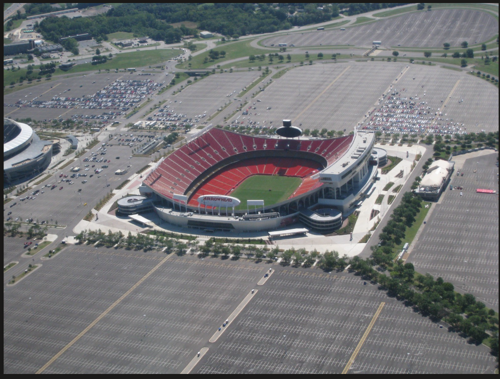
GEHA Field at Arrowhead Stadium. Image from bing
Arrowhead Stadium — officially GEHA Field at Arrowhead Stadium since a 2021 naming rights deal — has served as the home of the Kansas City Chiefs since 1972. It was built as part of the Truman Sports Complex alongside Kauffman Stadium, home of the Kansas City Royals, in a classic mid-century suburban sports complex model: car-centric, highway-adjacent, and designed with the assumption that everyone drives. Notably, a downtown site near what is now the Kauffman Center was considered first, but when land assembly in the urban core fell through, Jackson County stepped in with a 370-acre parcel at the interchange of I-70 and I-435 — an industrial area known as the Leeds site. The complex was financed almost entirely with public dollars: a $102 million general obligation bond (roughly $712 million today) approved by Jackson County voters in 1967 with 69% support. The land purchase alone — 220 of the 370 acres acquired in a single transaction — was the largest land deal in county history. The Jackson County Sports Complex Authority has owned the facility ever since, with the teams as tenants.
The public subsidy never really stopped. A 3/8-cent county sales tax has funded ongoing operations and renovations, including a $375 million renovation completed in 2010. Transit access has remained an afterthought throughout: the only regular service to the complex has been event shuttle buses, and a long-studied east-west high-capacity transit connection to the stadiums has never been built. The diverging fates of the two Truman Sports Complex tenants tell an interesting story: the Royals announced plans in April 2026 to partner with Hallmark Cards to develop a new downtown stadium at Crown Center and Washington Square Park, adjacent to Union Station and the KC Streetcar. The Chiefs, meanwhile, last year announced plans to leave Arrowhead for a new $3 billion domed stadium in Wyandotte County, Kansas — to be built near a highway interchange next to a regional shopping mall, essentially replicating the suburban car-centric model in a different suburb across a state line.
Transit
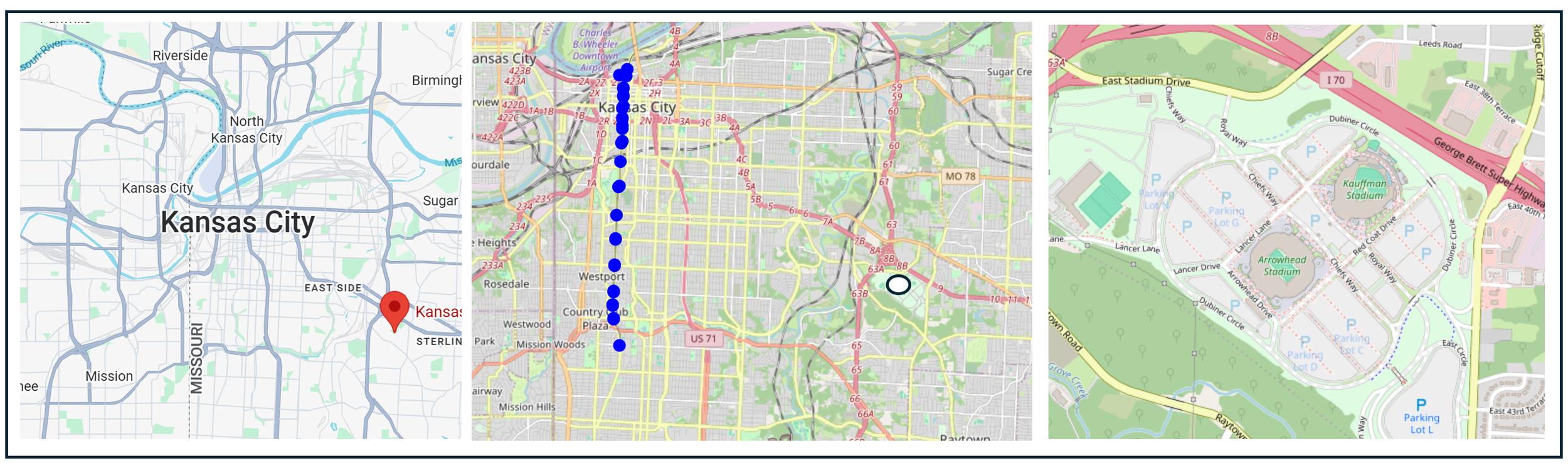
From left: Stadium location regional overview, stadium location compared to the location of the Kansas City Streetcar, and stadium closeup with surrounding streets.
Kansas City dismantled its streetcar system in 1957 — the last city of its size to do so — and spent the following six decades as one of the most car-dependent major metros in the United States. The KCATA, created in 1965, built a bus network that has always struggled with coverage in a sprawling, low-density region with limited political will for transit investment. Various proposals for east-west rail connecting downtown Kansas City to the eastern suburbs — and to Arrowhead — have been studied, proposed, and shelved repeatedly over the past forty years without ever reaching a ballot. The downtown KC Streetcar, opened in 2016 to considerable local enthusiasm serves the urban core but nothing beyond it. Arrowhead Stadium has never had rail access, never been included in any transit plan that advanced beyond a study, and the Chiefs' announced departure to a new highway-interchange stadium in Wyandotte County suggests the franchise has no interest in changing that. The World Cup is, in effect, forcing Kansas City to construct a temporary transit network from scratch — a system of charter coaches and park-and-ride lots — to substitute for the regional rapid transit that was never built.
Urban Fabric and Vitality
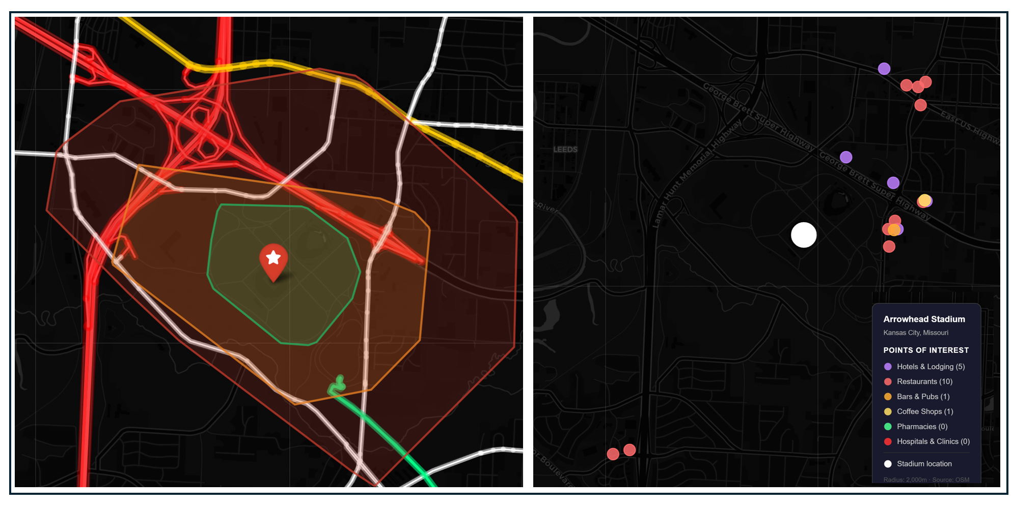
Left: Isochrone map showing a 10-, 20-, and 30-minute walk from the stadium. Highways shaded bright red, arterial roads shaded yellow and bike trails shaded green. Right: Hotels and game-day amenities within 30 minutes of the stadium.
Arrowhead’s surrounding roadway network is similar to the Meadowlands: designed for drivers, not for people walking or biking to the game. There are only a handful of places to stay, eat, and drink near the stadium.
Parking and Demand Management
Kansas City joins Seattle, Boston, and New Jersey on the list of host cities with specific parking restrictions. Arrowhead normally has 20,000 parking spots, but during World Cup matches only about 3,000–4,000 will be available. FIFA's parking website shows Kansas City Stadium lot pricing starting at $125–$150 per car for group stage matches, and up to $225 for the quarterfinal match
Projected Attendance
Kansas City will host six FIFA World Cup 2026 matches at Arrowhead Stadium between June 16 and July 11, including four group stage matches, one Round of 32 match, and a quarterfinal. Participating countries include Argentina, Algeria, Ecuador, Curaçao, Tunisia, the Netherlands and Austria.
At roughly 66,000 per match over six games, total cumulative attendance approaches 400,000 fans. Kansas City is also one of the venues hosting Argentina — with Lionel Messi — in the group stage, which will drive significant international attendance.
Downstream Effects
Transportation Investments
Kansas City built its transportation solution from scratch under the ConnectKC26 brand. Charter service provided for fans is the substitute for regional public transit. KC2026 has contracted 215 motorcoach buses for service zones labeled Airport Direct, Region Direct, and Stadium Direct. The reporting does not break out how many are dedicated to Stadium Direct specifically, but on match days the bulk of the fleet would logically pivot to stadium service.
Game Day Crowding and Safety
Perhaps ironically, the absence of any transit near the stadium eliminates the risk of chokepoints at stations and the distributed shuttle system may reduce the risk of crowding at any one pickup location. The greatest risk of crowds overwhelming capacity may be after the end of each game, as fans who did not drive themselves will need to board shuttles near the stadium and have no walking, biking, or transit alternative.
Fan Travel Time and Cost
Fans traveling from the FIFA Fan Festival location at the National WWI Museum would typically be able to drive to Arrowhead in 15–20 minutes. On match days with 65,000+ fans converging on the same highway corridors, a realistic shuttle ride is probably 25–40 minutes one way — making the full door-to-door experience from the Fan Festival to your seat closer to 45–60 minutes once you factor in boarding, traffic, and the walk from the bus drop-off point. A broader regional bus network connects the FIFA Fan Festival with key locations across the metro area, including Johnson County, Kansas neighborhoods, with a one-day pass at $5, a seven-day pass at $25, or a full tournament pass for $50
Game ticket holders can take a direct shuttle to the stadium from the FIFA Fan Festival or four designated park-and-ride locations for $15 per rider per match, round trip.
Impact on Regular Transit Riders
Kansas City’s plans to shuttle fans to and from the stadium essentially segregate game day travel from regular transit travel, meaning no impact on people commuting to work or school on KCATA’s bus network. Regular riders of the KC Streetcar may experience greater crowding from fans gathering downtown.
Cost to Public Agencies and the Taxpayer
The total cost of providing World Cup transportation has not been consolidated in a single public figure, though there have been some news reports of how costs will be paid for. One report indicates KCATA plans to use more than $2 million from a federal grant it received in 2018, which was originally intended to buy new buses, to operate the expanded service. Another indicates Congressman Mark Alford announced a separate federal grant award of $13.3 million for KCATA to support buying and rehabilitating buses, vans, and related equipment ahead of the World Cup. Although the city received $8.6 million under the FTA formula, these funds cannot be used to support charter service ferrying fans to and from the stadium.
Carbon Footprint
Medium, as is the case with Los Angeles and New England, the limits placed on stadium parking will cut down on emissions from personal vehicles but the extensive use of regional, motor coach transportation raises emissions compared to a typical day in the region.
#10: Dallas-Fort Worth
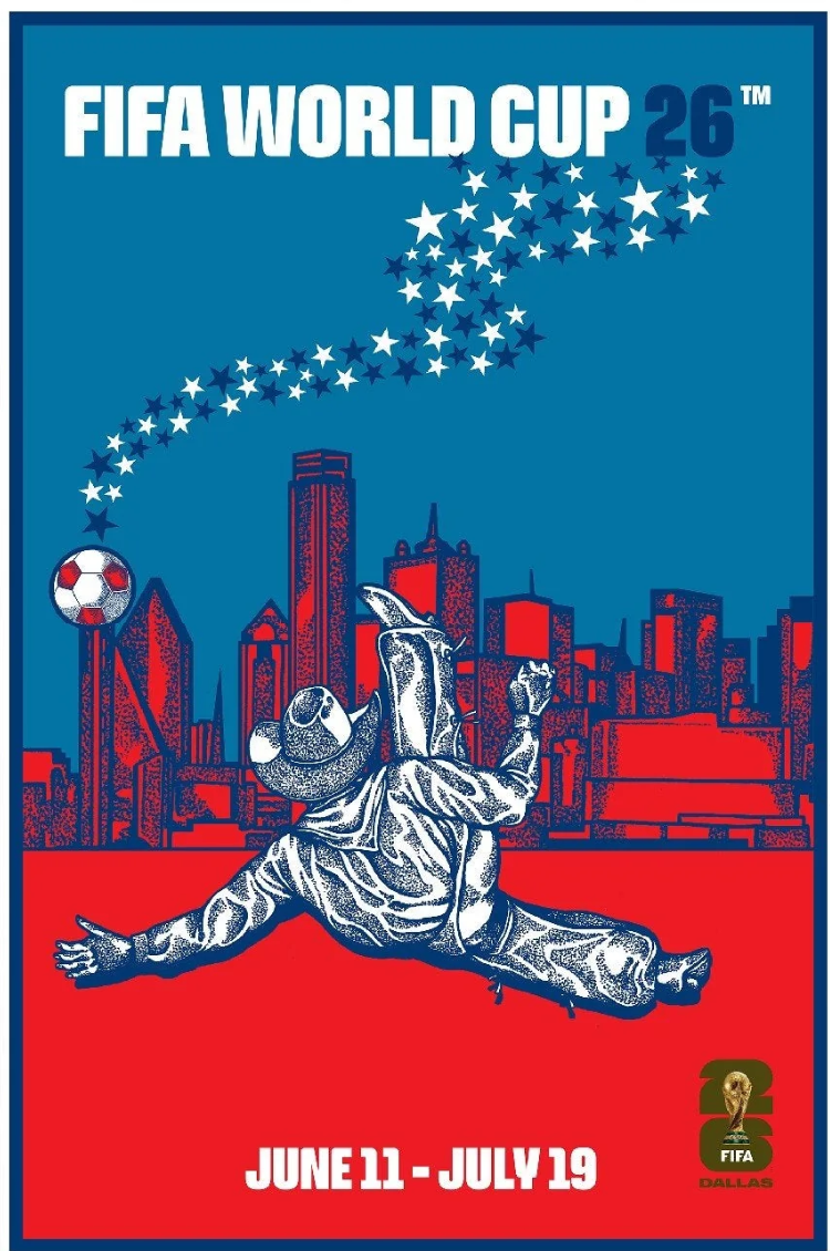
Official Dallas World Cup Poster by Matt Cliff. Source
Dallas-Fort Worth ranks tenth, and its case study most directly illustrates the structural disconnect between transit governance and sports infrastructure governance that runs through this entire essay. A stadium that could have been built next to a DART station is instead paired with a city that sees public transportation as something that belongs in…New York. The result: dozens of motor coaches on area roads and a $68.2 million price tag.
Stadium
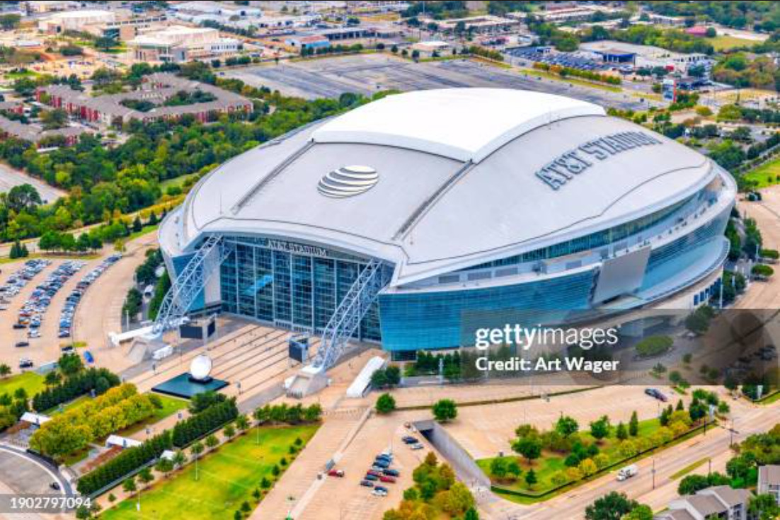
AT&T Stadium. Image from bing
AT&T Stadium — known informally as "Jerry World" after Cowboys owner Jerry Jones, and officially renamed Dallas Stadium for the 2026 World Cup — sits in Arlington, Texas, the product of a decade-long stadium search that came tantalizingly close to producing a very different outcome for Dallas. The Cowboys had played since 1971 at Texas Stadium in Irving, a suburb west of Dallas, having abandoned the Cotton Bowl at Fair Park in a classic mid-century flight from the urban core. By the early 2000s, Jones was serious about building something new — and his original vision was genuinely urban. Between 2002 and 2004, the Cowboys spent nearly $4 million studying a site in the Cedars neighborhood, a brownfield area between Lamar Street and the Trinity River just east of downtown Dallas. Jones commissioned environmental studies, had architects produce computer-animated renderings of a stadium in the shadow of the Dallas skyline, and scaled back his planned surrounding entertainment district because the site couldn't accommodate it at full scale. Dallas city officials were quietly enthusiastic — they saw the Cowboys as a catalyst that could accelerate DART light rail service to Fair Park and anchor a broader downtown revitalization. Jones' personal motivation was partly legacy: bringing America's Team back to Dallas while rebuilding a decaying part of the city was the kind of thing money alone couldn't buy.
The deal unraveled for a tangle of reasons. The financing structure — built around a hotel and car rental tax increase — would have pushed Dallas's hotel tax to 18 percent, among the highest in the country, triggering quiet opposition from the convention industry. Dallas County Judge Margaret Keliher dismissed the Cedars site as "a billion-dollar project on 50-cent land" and steered negotiations toward Fair Park instead, the historic grounds where the Cowboys had originally played at the Cotton Bowl and where DART's Green Line was already under construction. The Fair Park proposal required $425 million in public financing and collapsed in June 2004 when county commissioners said they couldn't justify putting it to voters. Jones then turned to Arlington, which offered everything Dallas wouldn't: a compliant city government, a voter-approved $325 million bond package funded through sales, hotel, and car rental taxes, and — crucially — no questions asked about eminent domain. The city cleared the chosen site, displacing nearly 1,200 residents from more than 100 homes and apartment buildings, falsely claiming the neighborhood was blighted when housing prices and crime rates were in fact average for Arlington.
Transit
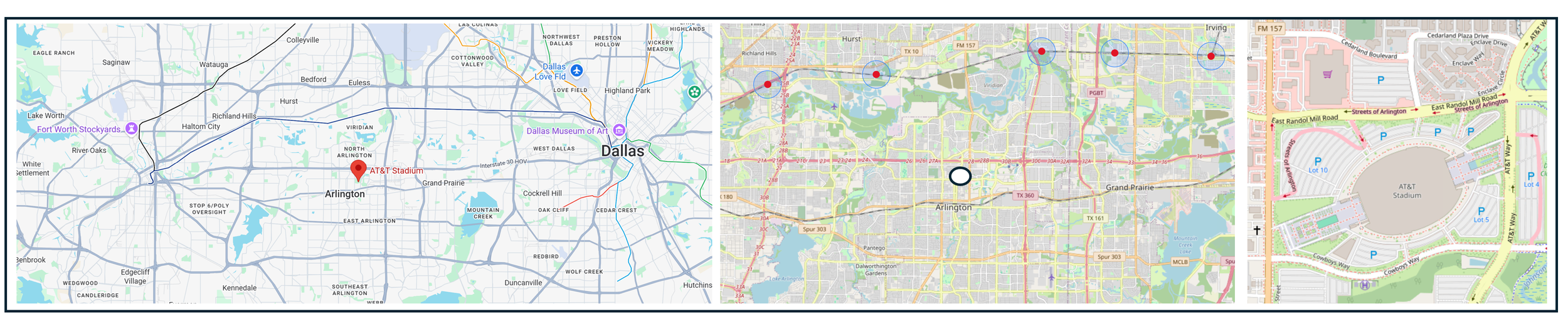
From left: Stadium location regional overview, stadium location with nearby transit stations (the blue circles = a ½ mile radius around the station) and stadium closeup with surrounding streets.
Arlington Texas is, by its own repeated choice, the largest city in the United States without a mass public transit system — a distinction earned through three separate voter rejections of transit proposals in 1980, 1995, and 2002. The city sits squarely between Dallas's DART network and Fort Worth's Trinity Metro system and has declined to join either. A brief experiment with a single DART bus route, launched in 2013, was discontinued in 2017 citing low ridership and replaced with an on-demand rideshare app. AT&T Stadium itself was designed with highway visibility as a priority — Jones reportedly worried during construction that the 300-foot-tall, 3-million-square-foot structure might not be visible from Interstate 30. The irony is complete: DART's Green Line station at Fair Park, which opened the same year as AT&T Stadium in 2009, serves the FIFA Fan Festival site for the 2026 World Cup — a transit-connected venue that could have been the Cowboys' home, had the politics broken differently.
The Trinity Railway Express, a joint DART/Trinity Metro commuter service connecting Dallas and Fort Worth, passes through CentrePort/DFW Airport station, which becomes the key transfer point for World Cup fans — but CentrePort is still several miles from AT&T Stadium, requiring a bus bridge.
Urban Fabric and Vitality
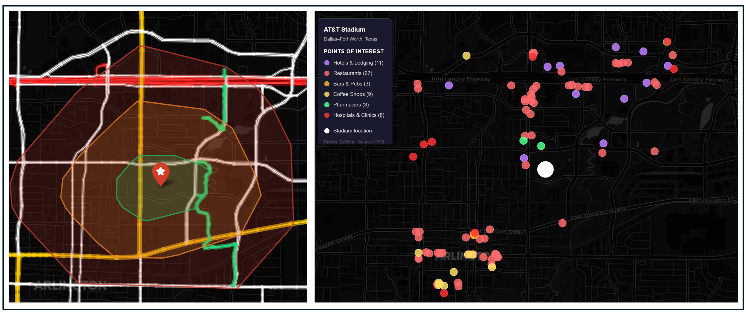
Left: Isochrone map showing a 10-, 20-, and 30-minute walk from the stadium. Highways shaded bright red, arterial roads shaded yellow and bike trails shaded green. Right: Hotels and game-day amenities within 30 minutes of the stadium.
Both Arlington, TX and Inglewood, CA share similarities when it comes to the land use and transportation features surrounding their stadiums. Both are located too far from a transit station to comfortably walk to games, but, as is the case with SoFi stadium, spectators who choose to stay near AT&T stadium will be able to walk to the game and to nearby destinations. While the number of fans who exercise this opportunity is a small fraction of the total, it could provide some relief for driving and transit congestion.
Parking and Demand Management
Over 16,000 spaces will be open for general parking, with residents encouraged to drive. Official FIFA parking passes will likely cost between $75 and $175 per vehicle per game, with dynamic pricing that could push sellout-game prices above $200.
Projected Attendance
An estimated 70,000-plus fans are expected to attend each of the nine matches at AT&T Stadium. The stadium has a capacity of approximately 94,000 spectators for the World Cup, making it the largest venue in the tournament. Across nine matches at roughly 80,000–94,000 attendance each, total cumulative attendance could approach or exceed 700,000, and North Texas expects over 1.2 million international visitors for the tournament.
Downstream Effects
Transportation Investments
Because there is no direct rail transit access to AT&T Stadium, organizers have designed a multi-modal approach with the Trinity Railway Express (TRE) as the spine. Fans will board the Trinity Railway Express from downtown Dallas (Victory Station) or downtown Fort Worth (Central Station), ride to CentrePort Station, then transfer to charter buses bound for a designated bus hub near the stadium. From the bus hub, fans will walk approximately a half mile to the venue. If crowds overwhelm the rail system, buses may bypass the train entirely and take fans directly to the stadium from downtown Dallas or Fort Worth. Designated rideshare pick-up and drop-off operations are planned at the Esports Stadium Arlington parking lot, about 0.7 miles from the stadium.
Game Day Crowding and Safety
As is the case in New Jersey and Philadelphia, AT&T will be served by a single station, CentrePort, and the added fact that fans will access the rail station by charter bus may increase the complications of getting fans to and from the game and the risk of crowding. The extent to which game day crowding on rail occurs may be due in part to the number of people who choose to stay near the stadium and travel by foot or, more significantly, the number of people who drive and park.
Fan Travel Time and Cost
Total door-to-stadium travel time from downtown Dallas or Fort Worth is estimated at about 90 minutes. Officials recommend beginning the journey up to four hours before kickoff. TRE fares are approximately $2.50 to $5.00
Impact on Regular Transit Riders
Officials have not announced any schedule changes or disruptions to regular transit service, though commuters using TRE would expect many more fellow passengers on game days.
Cost to Public Agencies and the Taxpayer
The North Central Texas Council of Governments (the regional planning agency) has committed more than $40 million to World Cup preparations over the last two years and the private charter shuttles from CentrePoint to the stadium are paid for by NCTCOG. Dallas Area Rapid Transit (DART) estimates an $18.2 million price tag for its World Cup operations, with nearly half coming from extending TRE trains to four cars each. Trinity Metro approved a contract of up to $6 million to lease up to 40 buses daily for 42 days.
Carbon Footprint
High. The large numbers of travelers expected at the game combined with no announced restrictions on parking and at least 40 motor coaches providing “last-mile” transportation to the game are conditions that would maximize tailpipe emissions from multiple sources.
#11: Miami
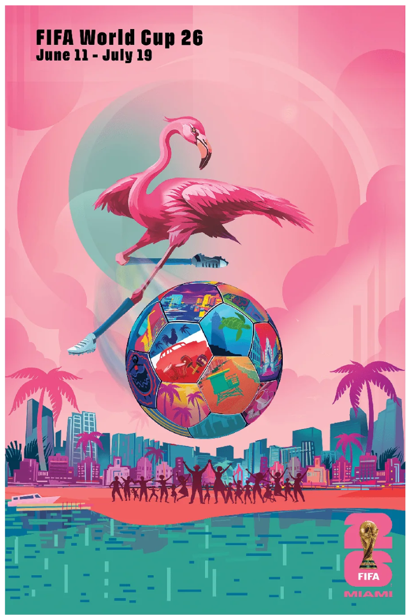
Official Miami World Cup poster by Rubem Robierb. Source
Well, some host city needs to finish last. In the race to the bottom between Dallas and Miami, Dallas seems to be trying harder to provide alternatives to driving to the games whereas Miami has announced that its stadium parking lot is already sold out. That said, I will be revising these sustainability rankings after the World Cup has ended to take into account how agencies in the host cities actually performed in providing transportation. Miami, prove me wrong!
Stadium
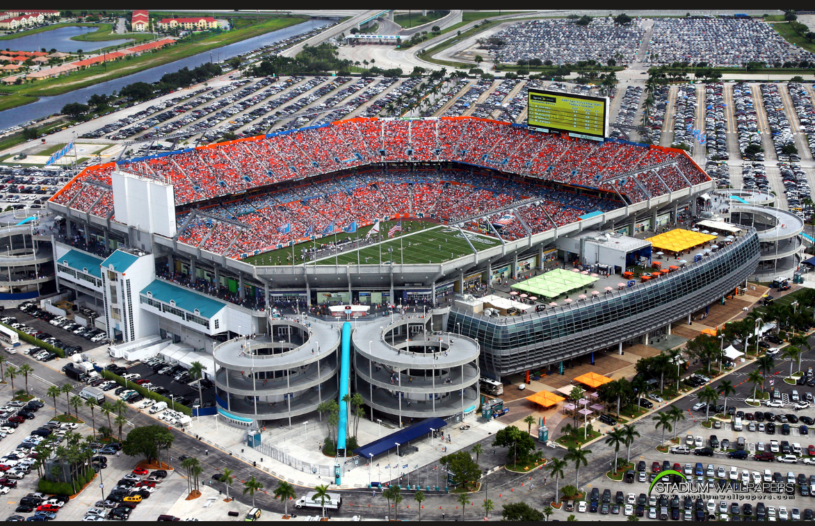
Hard Rock Stadium. Image from bing
Hard Rock Stadium — known at various points as Joe Robbie Stadium, Pro Player Stadium, Dolphins Stadium, and Sun Life Stadium before its current name took effect in 2016 — has served as the home of the Miami Dolphins since 1987. Its origin story is inseparable from the one it left behind. For their first 21 seasons, the Dolphins played at the Orange Bowl, a Depression-era WPA project built in 1937 in what became the Little Havana neighborhood west of downtown Miami. The stadium was famously intimate and loud — 80,000 fans, seats close to the field, virtually no parking — but by the 1970s, the franchise's relationship with the city had soured. As Cuban and Latin American immigrants transformed the surrounding neighborhood, the Dolphins' predominantly white suburban fan base migrated outward, and the franchise followed. The immediate trigger was a 1976 dispute in which the city of Miami sought to quadruple the team's rent — but the underlying dynamic was demographic: the team was relocating to follow its audience. Joe Robbie selected a 160-acre site in unincorporated Miami-Dade County, roughly 14 miles north of downtown, chosen primarily for its highway access to the entire tri-county South Florida market via I-95 and the Florida Turnpike.
Transit
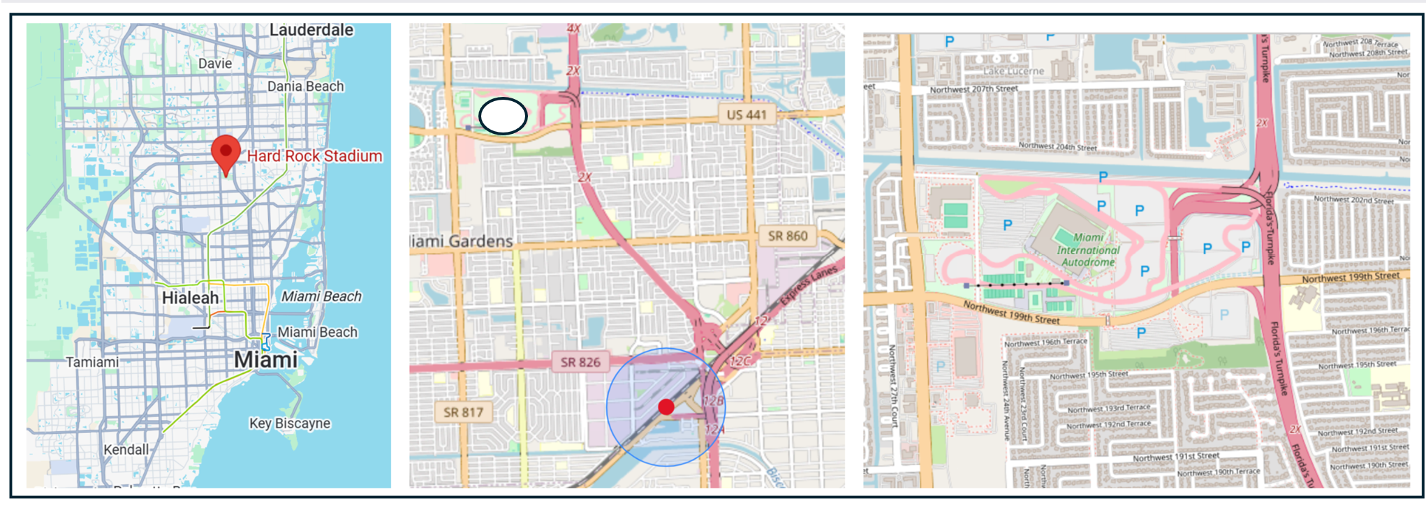
From left: Stadium location regional overview, stadium location with the closest transit station (the blue circles = a ½ mile radius around the station) and stadium closeup with surrounding streets.
Miami-Dade's Metrorail opened in 1984 as one of the first heavy rail systems built in the Sun Belt, a genuine infrastructure achievement for a region more commonly associated with highways and sprawl. But the system's 25-mile backbone runs north-south through the urban core, and its northern terminus stops miles short of Hard Rock Stadium — a gap that has been identified, studied, funded, and re-deferred for thirty years. The North Corridor extension, which would run elevated along NW 27th Avenue to a terminus at the stadium, has been formally included in Miami-Dade's SMART (Strategic Miami Area Rapid Transit) program since 2016 and was once projected for completion in time for this World Cup. It is now not expected until 2036. Communities along NW 27th Avenue — Liberty City, Little Haiti, Miami Gardens — are among Miami-Dade's most transit-dependent, lowest-income, and least politically powerful. The stadium that was promised a rail connection when it was built in 1987 still doesn't have one. Brightline, the privately operated intercity rail that connects Miami to Fort Lauderdale, West Palm Beach, and Orlando, adds a useful option for out-of-region visitors but does not address the fundamental gap: the stadium sits in a transit desert that public investment has declined to fix.
Urban Fabric and Vitality
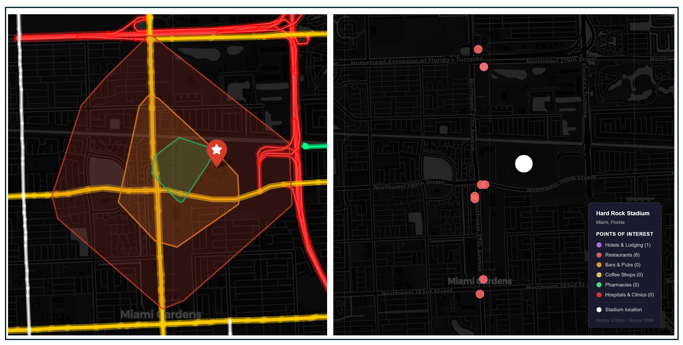
Left: Isochrone map showing a 10-, 20-, and 30-minute walk from the stadium. Highways shaded bright red, arterial roads shaded yellow and bike trails shaded green. Right: Hotels and game-day amenities within 30 minutes of the stadium.
Hard Rock Stadium joins its car-focused contemporaries in New Jersey, New England, Kansas City, and Dallas. But while these places have made an attempt to provide a mix of uses offering some lodging, food, and destinations within walking distance of the sports complex, Hard Rock stadium doesn’t even try. OpenStreetMap lists ten points of interest within a 30 minute walk of the stadium.
Parking Policies and Demand Management
Hard Rock Stadium has up to 27,000 parking spaces across multiple lots, with parking fees ranging from $175 to $250. Organizers have not announced a parking cap or a specific number of spots available, but according to the Stadium website, stadium parking spots are sold out.
Miami is offering fans who take Metrorail, Tri-Rail, Metrobus, Miami Trolley, or Broward County Transit to matches a $10 food and beverage credit at Hard Rock Stadium concessions, making it the only host city to offer this type of transit incentive.
Projected Attendance
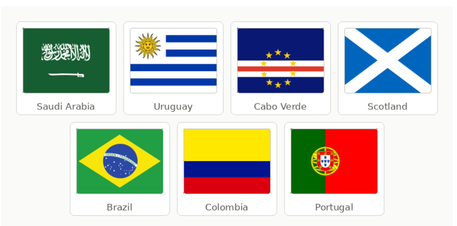
Hard Rock Stadium will have a seated capacity of 65,000 for its seven World Cup matches. At capacity across seven matches, cumulative attendance approaches 455,000 fans, making Miami one of the more heavily attended venues in the tournament. Participating countries include Saudi Arabia, Uruguay, Cape Verde, Scotland, Brazil, Columbia, and Portugal.
Downstream Effects
Transportation Investments
Fans can travel from Miami, West Palm Beach, Boca Raton, Fort Lauderdale, or Orlando to Brightline's Aventura Station, where a free shuttle departs for the stadium approximately 10 minutes after arrival. Fans can take Tri-Rail to Golden Glades Station, and board the GEICO Hard Rock Stadium Express Shuttle. Fans can take Metrorail from Brickell Station to Palmetto Station, then connect to stadium shuttle service, with Miami-Dade Transit charging $2.25 per trip. FIFA and the Miami Host Committee have arranged special buses departing from NW 2nd Avenue on a rolling schedule starting three hours before kickoff, running until two hours after the final whistle, with fares of $15–$25 per ride. Metrobus Route 27 runs along 27th Avenue and is one of the most direct public bus connections from central Miami to Miami Gardens, with expanded service on match days.
Game Day Crowding and Safety
Fans will be able to choose from several different transit lines to get to the stadium and since there is no obvious close transit station, game-day transit crowding may not be that bad.
Fan Travel Time and Cost
When it comes to travel time, all of the rai/shuttle options land in roughly the same range: 45–85 minutes door to door, with the direct shuttle from NW 2nd Avenue being potentially the fastest in ideal conditions and the Metrorail route being the most variable. Costs on public transit range from $2.50 for the Metrorail option to $25 to the direct shuttle from downtown. Brightline, a private rail service, is employing dynamic pricing with round trip tickets ranging from $24 to $151.
Impact on Regular Transit Users
Miami’s approach is to direct fans to game-day shuttles rather than reshape existing transit service patterns, so typical commuters may not experience much of an impact.
Cost to Public Agencies and the Taxpayer
Miami-Dade County’s 2026 budget includes a $10.5 million subsidy for the 2026 World Cup games, however a breakdown of what specific transit agencies (Miami-Dade Transit and Brightline) will spend is not available.
Carbon Footprint
High. Whereas the total number of people who will end up driving to games in other host cities is to be determined, Stadium parking in Miami is sold out, thereby locking in tailpipe emissions from personal vehicles. Additional bus bridges traveling relatively long distances from transit stations to the game add to the emissions load.
We have met the opposing team, and they are us
If you’re an urbanist, like me, it’s easy to find villains amongst the stories of the eleven host cities. FIFA extracted billions while cities absorbed costs. Billionaire stadium owners routinely hold their host cities over a barrel by threatening to move their teams elsewhere. Stan Kroenke killed a federally funded transit connector to his own stadium rather than contribute to its construction. Arlington, Texas voted against joining DART three times, and Miami let a rail line through its most transit-dependent neighborhoods slip to 2036 for the fourth decade in a row.
But the essay's honest conclusion is that the opposing team, in many of these cities, turns out to be us. The politics of sports infrastructure is not simple. Building stadiums in cities engenders opposition, as well as support among progressives due to valid concerns about gentrification, displacement, and the best use of taxpayer funds. Building new transit rail lines carries very real costs both in dollars and time expended in a country that spends more and takes longer to build public works than its international peers. Community leaders who rejected urban stadiums or transit expansions often reflect the interests of their voters.
None of that makes the outcomes less consequential for the commuter who missed her train or the community that's still waiting for its rail line. But it does make the question of what comes next more interesting than the question of who was to blame.
In August, once the roar of the fans subsides, once the winners have won, the losers have lost, and the last bus or train has left the station, civic leaders in each city will have a chance to reflect on what happened, what they value, what they are willing to build next, and who they are willing to build it for.


